You are here: Home > Network List > US - United States National Seismic Network Stations List
> Station BOZ Bozeman, Montana, USA > Earthquake Result Viewer
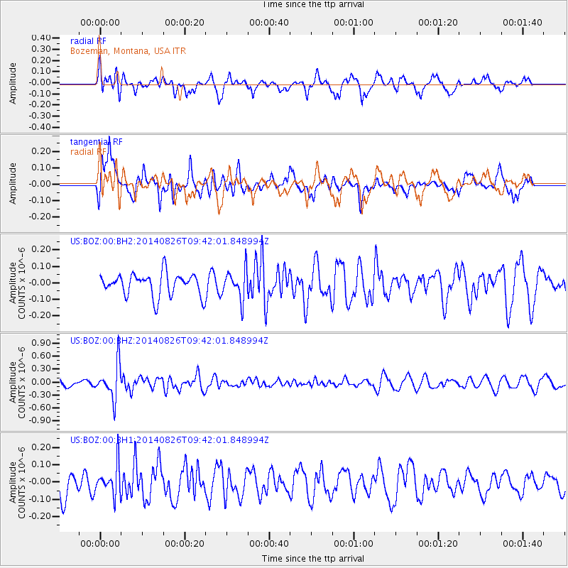
BOZ Bozeman, Montana, USA - Earthquake Result Viewer
*The percent match for this event was below the threshold and hence no stack was calculated.
| Earthquake location: |
Tonga Islands |
| Earthquake latitude/longitude: |
-15.2/-173.2 |
| Earthquake time(UTC): |
2014/08/26 (238) 09:30:12 GMT |
| Earthquake Depth: |
10 km |
| Earthquake Magnitude: |
5.6 MB |
| Earthquake Catalog/Contributor: |
NEIC PDE/NEIC COMCAT |
|
| Network: |
US United States National Seismic Network |
| Station: |
BOZ Bozeman, Montana, USA |
| Lat/Lon: |
45.65 N/111.63 W |
| Elevation: |
1589 m |
|
| Distance: |
82.1 deg |
| Az: |
38.495 deg |
| Baz: |
238.932 deg |
| Ray Param: |
$rayparam |
*The percent match for this event was below the threshold and hence was not used in the summary stack. |
|
| Radial Match: |
52.240814 % |
| Radial Bump: |
400 |
| Transverse Match: |
57.27685 % |
| Transverse Bump: |
400 |
| SOD ConfigId: |
769524 |
| Insert Time: |
2014-09-09 10:01:24.504 +0000 |
| GWidth: |
2.5 |
| Max Bumps: |
400 |
| Tol: |
0.001 |
|
Signal To Noise
| Channel | StoN | STA | LTA |
| US:BOZ:00:BHZ:20140826T09:42:01.848994Z | 5.2817974 | 4.1330313E-7 | 7.825047E-8 |
| US:BOZ:00:BH1:20140826T09:42:01.848994Z | 1.0504489 | 8.6972534E-8 | 8.279559E-8 |
| US:BOZ:00:BH2:20140826T09:42:01.848994Z | 1.3312136 | 9.074418E-8 | 6.816651E-8 |
| Arrivals |
| Ps | |
| PpPs | |
| PsPs/PpSs | |


