You are here: Home > Network List > UW - Pacific Northwest Regional Seismic Network Stations List
> Station LEBA Lebam, WA, USA > Earthquake Result Viewer
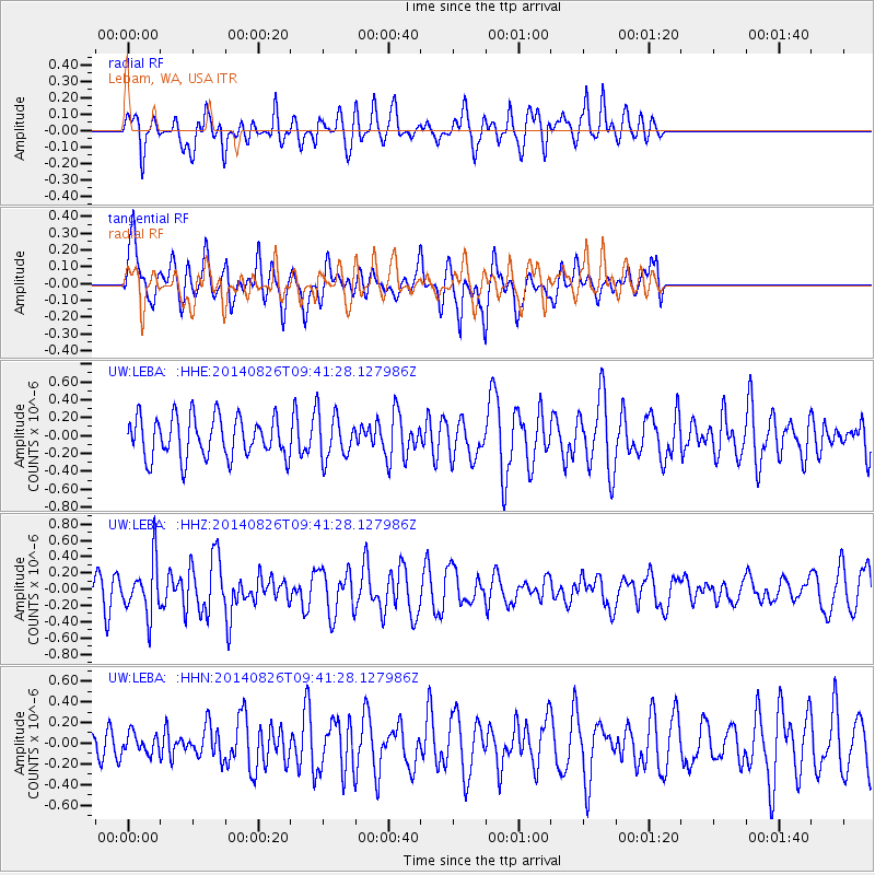
LEBA Lebam, WA, USA - Earthquake Result Viewer
*The percent match for this event was below the threshold and hence no stack was calculated.
| Earthquake location: |
Tonga Islands |
| Earthquake latitude/longitude: |
-15.2/-173.2 |
| Earthquake time(UTC): |
2014/08/26 (238) 09:30:12 GMT |
| Earthquake Depth: |
10 km |
| Earthquake Magnitude: |
5.6 MB |
| Earthquake Catalog/Contributor: |
NEIC PDE/NEIC COMCAT |
|
| Network: |
UW Pacific Northwest Regional Seismic Network |
| Station: |
LEBA Lebam, WA, USA |
| Lat/Lon: |
46.55 N/123.56 W |
| Elevation: |
73 m |
|
| Distance: |
75.9 deg |
| Az: |
32.803 deg |
| Baz: |
229.261 deg |
| Ray Param: |
$rayparam |
*The percent match for this event was below the threshold and hence was not used in the summary stack. |
|
| Radial Match: |
58.74732 % |
| Radial Bump: |
400 |
| Transverse Match: |
52.273506 % |
| Transverse Bump: |
400 |
| SOD ConfigId: |
769524 |
| Insert Time: |
2014-09-09 10:03:27.022 +0000 |
| GWidth: |
2.5 |
| Max Bumps: |
400 |
| Tol: |
0.001 |
|
Signal To Noise
| Channel | StoN | STA | LTA |
| UW:LEBA: :HHZ:20140826T09:41:28.127986Z | 2.3433113 | 3.226602E-7 | 1.3769413E-7 |
| UW:LEBA: :HHN:20140826T09:41:28.127986Z | 0.5314439 | 9.414661E-8 | 1.7715247E-7 |
| UW:LEBA: :HHE:20140826T09:41:28.127986Z | 1.1204367 | 2.5463544E-7 | 2.2726445E-7 |
| Arrivals |
| Ps | |
| PpPs | |
| PsPs/PpSs | |


