You are here: Home > Network List > TA - USArray Transportable Network (new EarthScope stations) Stations List
> Station D48A Paudash Township, ON, CAN > Earthquake Result Viewer
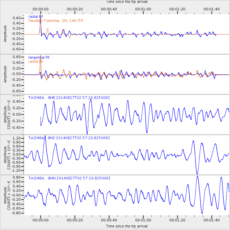
D48A Paudash Township, ON, CAN - Earthquake Result Viewer
*The percent match for this event was below the threshold and hence no stack was calculated.
| Earthquake location: |
Iceland |
| Earthquake latitude/longitude: |
64.7/-17.0 |
| Earthquake time(UTC): |
2014/08/27 (239) 02:50:39 GMT |
| Earthquake Depth: |
5.0 km |
| Earthquake Magnitude: |
5.6 M |
| Earthquake Catalog/Contributor: |
NEIC PDE/NEIC ALERT |
|
| Network: |
TA USArray Transportable Network (new EarthScope stations) |
| Station: |
D48A Paudash Township, ON, CAN |
| Lat/Lon: |
47.17 N/81.81 W |
| Elevation: |
434 m |
|
| Distance: |
38.3 deg |
| Az: |
274.796 deg |
| Baz: |
38.913 deg |
| Ray Param: |
$rayparam |
*The percent match for this event was below the threshold and hence was not used in the summary stack. |
|
| Radial Match: |
69.94081 % |
| Radial Bump: |
311 |
| Transverse Match: |
49.976166 % |
| Transverse Bump: |
400 |
| SOD ConfigId: |
769524 |
| Insert Time: |
2014-09-10 03:21:24.343 +0000 |
| GWidth: |
2.5 |
| Max Bumps: |
400 |
| Tol: |
0.001 |
|
Signal To Noise
| Channel | StoN | STA | LTA |
| TA:D48A: :BHZ:20140827T02:57:29.825006Z | 4.160749 | 6.9649656E-7 | 1.6739692E-7 |
| TA:D48A: :BHN:20140827T02:57:29.825006Z | 1.8794601 | 2.4431938E-7 | 1.2999445E-7 |
| TA:D48A: :BHE:20140827T02:57:29.825006Z | 1.5303326 | 2.631222E-7 | 1.7193793E-7 |
| Arrivals |
| Ps | |
| PpPs | |
| PsPs/PpSs | |


