You are here: Home > Network List > TA - USArray Transportable Network (new EarthScope stations) Stations List
> Station J01E Myrtle Point, OR, USA > Earthquake Result Viewer
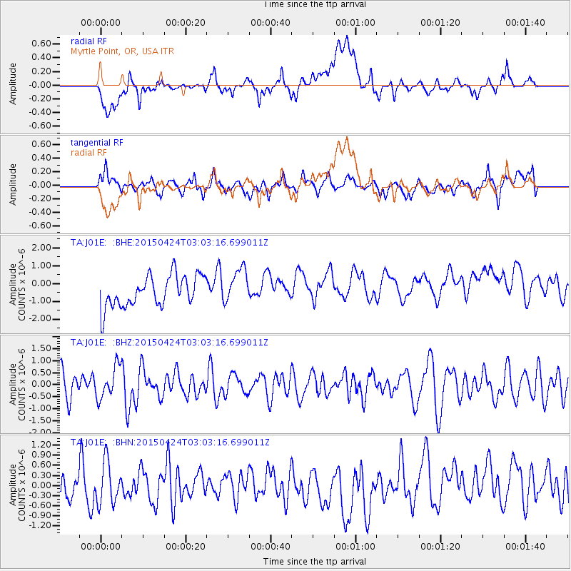
J01E Myrtle Point, OR, USA - Earthquake Result Viewer
*The percent match for this event was below the threshold and hence no stack was calculated.
| Earthquake location: |
Solomon Islands |
| Earthquake latitude/longitude: |
-6.4/155.1 |
| Earthquake time(UTC): |
2015/04/24 (114) 02:51:04 GMT |
| Earthquake Depth: |
56 km |
| Earthquake Magnitude: |
5.0 MW, 3.9 MS, 5.1 mb |
| Earthquake Catalog/Contributor: |
ISC/ISC |
|
| Network: |
TA USArray Transportable Network (new EarthScope stations) |
| Station: |
J01E Myrtle Point, OR, USA |
| Lat/Lon: |
43.16 N/123.93 W |
| Elevation: |
128 m |
|
| Distance: |
87.8 deg |
| Az: |
46.319 deg |
| Baz: |
259.201 deg |
| Ray Param: |
$rayparam |
*The percent match for this event was below the threshold and hence was not used in the summary stack. |
|
| Radial Match: |
51.84884 % |
| Radial Bump: |
400 |
| Transverse Match: |
52.61805 % |
| Transverse Bump: |
400 |
| SOD ConfigId: |
7422571 |
| Insert Time: |
2019-04-18 08:15:26.788 +0000 |
| GWidth: |
2.5 |
| Max Bumps: |
400 |
| Tol: |
0.001 |
|
Signal To Noise
| Channel | StoN | STA | LTA |
| TA:J01E: :BHZ:20150424T03:03:16.699011Z | 1.5561136 | 6.822909E-7 | 4.384583E-7 |
| TA:J01E: :BHN:20150424T03:03:16.699011Z | 1.3853681 | 6.4256346E-7 | 4.6382146E-7 |
| TA:J01E: :BHE:20150424T03:03:16.699011Z | 1.1423161 | 9.979768E-7 | 8.7364333E-7 |
| Arrivals |
| Ps | |
| PpPs | |
| PsPs/PpSs | |


