You are here: Home > Network List > US - United States National Seismic Network Stations List
> Station HAWA Hanford, Washington, USA > Earthquake Result Viewer
HAWA Hanford, Washington, USA - Earthquake Result Viewer
*The percent match for this event was below the threshold and hence no stack was calculated.
| Earthquake location: |
Vanuatu Islands |
| Earthquake latitude/longitude: |
-15.1/167.3 |
| Earthquake time(UTC): |
2014/08/27 (239) 23:11:35 GMT |
| Earthquake Depth: |
119 km |
| Earthquake Magnitude: |
5.8 M |
| Earthquake Catalog/Contributor: |
NEIC PDE/NEIC ALERT |
|
| Network: |
US United States National Seismic Network |
| Station: |
HAWA Hanford, Washington, USA |
| Lat/Lon: |
46.39 N/119.53 W |
| Elevation: |
364 m |
|
| Distance: |
89.6 deg |
| Az: |
41.484 deg |
| Baz: |
247.578 deg |
| Ray Param: |
$rayparam |
*The percent match for this event was below the threshold and hence was not used in the summary stack. |
|
| Radial Match: |
56.33513 % |
| Radial Bump: |
400 |
| Transverse Match: |
44.78953 % |
| Transverse Bump: |
400 |
| SOD ConfigId: |
769524 |
| Insert Time: |
2014-09-10 23:34:04.216 +0000 |
| GWidth: |
2.5 |
| Max Bumps: |
400 |
| Tol: |
0.001 |
|
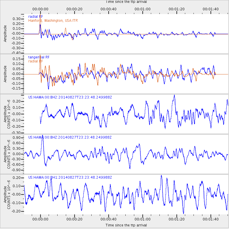
Signal To Noise
| Channel | StoN | STA | LTA |
| US:HAWA:00:BHZ:20140827T23:23:48.249988Z | 4.8869452 | 5.014397E-7 | 1.02608E-7 |
| US:HAWA:00:BH1:20140827T23:23:48.249988Z | 1.0501925 | 1.00387574E-7 | 9.558969E-8 |
| US:HAWA:00:BH2:20140827T23:23:48.249988Z | 1.5062772 | 9.363869E-8 | 6.216564E-8 |
| Arrivals |
| Ps | |
| PpPs | |
| PsPs/PpSs | |


