You are here: Home > Network List > US - United States National Seismic Network Stations List
> Station DGMT Dagmar, Montana, USA > Earthquake Result Viewer
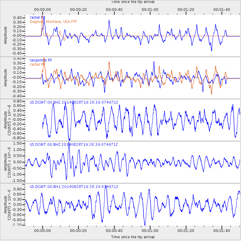
DGMT Dagmar, Montana, USA - Earthquake Result Viewer
*The percent match for this event was below the threshold and hence no stack was calculated.
| Earthquake location: |
Shikoku, Japan |
| Earthquake latitude/longitude: |
32.1/132.1 |
| Earthquake time(UTC): |
2014/08/28 (240) 19:14:35 GMT |
| Earthquake Depth: |
22 km |
| Earthquake Magnitude: |
5.8 MWB |
| Earthquake Catalog/Contributor: |
NEIC PDE/NEIC COMCAT |
|
| Network: |
US United States National Seismic Network |
| Station: |
DGMT Dagmar, Montana, USA |
| Lat/Lon: |
48.47 N/104.20 W |
| Elevation: |
0.0 m |
|
| Distance: |
85.3 deg |
| Az: |
33.744 deg |
| Baz: |
314.889 deg |
| Ray Param: |
$rayparam |
*The percent match for this event was below the threshold and hence was not used in the summary stack. |
|
| Radial Match: |
59.192192 % |
| Radial Bump: |
354 |
| Transverse Match: |
52.312702 % |
| Transverse Bump: |
400 |
| SOD ConfigId: |
769524 |
| Insert Time: |
2014-09-11 19:59:34.240 +0000 |
| GWidth: |
2.5 |
| Max Bumps: |
400 |
| Tol: |
0.001 |
|
Signal To Noise
| Channel | StoN | STA | LTA |
| US:DGMT:00:BHZ:20140828T19:26:39.674971Z | 2.2301154 | 3.908723E-7 | 1.7526997E-7 |
| US:DGMT:00:BH1:20140828T19:26:39.674971Z | 2.0002043 | 3.8317668E-7 | 1.9156877E-7 |
| US:DGMT:00:BH2:20140828T19:26:39.674971Z | 0.64270186 | 2.5605655E-7 | 3.984064E-7 |
| Arrivals |
| Ps | |
| PpPs | |
| PsPs/PpSs | |


