You are here: Home > Network List > TA - USArray Transportable Network (new EarthScope stations) Stations List
> Station R55A Marlinton, WV, USA > Earthquake Result Viewer
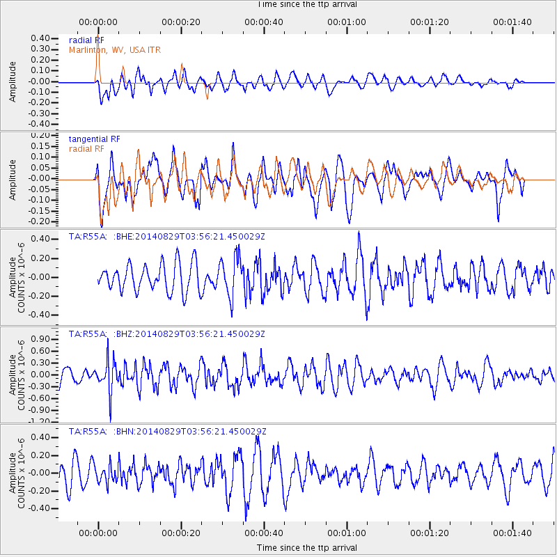
R55A Marlinton, WV, USA - Earthquake Result Viewer
*The percent match for this event was below the threshold and hence no stack was calculated.
| Earthquake location: |
Southern Greece |
| Earthquake latitude/longitude: |
36.7/23.8 |
| Earthquake time(UTC): |
2014/08/29 (241) 03:45:06 GMT |
| Earthquake Depth: |
92 km |
| Earthquake Magnitude: |
5.6 MB |
| Earthquake Catalog/Contributor: |
NEIC PDE/NEIC COMCAT |
|
| Network: |
TA USArray Transportable Network (new EarthScope stations) |
| Station: |
R55A Marlinton, WV, USA |
| Lat/Lon: |
38.28 N/80.12 W |
| Elevation: |
833 m |
|
| Distance: |
77.5 deg |
| Az: |
308.514 deg |
| Baz: |
53.004 deg |
| Ray Param: |
$rayparam |
*The percent match for this event was below the threshold and hence was not used in the summary stack. |
|
| Radial Match: |
53.950947 % |
| Radial Bump: |
400 |
| Transverse Match: |
61.022198 % |
| Transverse Bump: |
400 |
| SOD ConfigId: |
769524 |
| Insert Time: |
2014-09-12 04:14:16.183 +0000 |
| GWidth: |
2.5 |
| Max Bumps: |
400 |
| Tol: |
0.001 |
|
Signal To Noise
| Channel | StoN | STA | LTA |
| TA:R55A: :BHZ:20140829T03:56:21.450029Z | 2.5396824 | 3.8852727E-7 | 1.5298261E-7 |
| TA:R55A: :BHN:20140829T03:56:21.450029Z | 0.6913519 | 9.15458E-8 | 1.3241564E-7 |
| TA:R55A: :BHE:20140829T03:56:21.450029Z | 1.4592774 | 2.0811267E-7 | 1.426135E-7 |
| Arrivals |
| Ps | |
| PpPs | |
| PsPs/PpSs | |


