You are here: Home > Network List > LD - Lamont-Doherty Cooperative Seismographic Network Stations List
> Station MVL Millersville University, PA > Earthquake Result Viewer
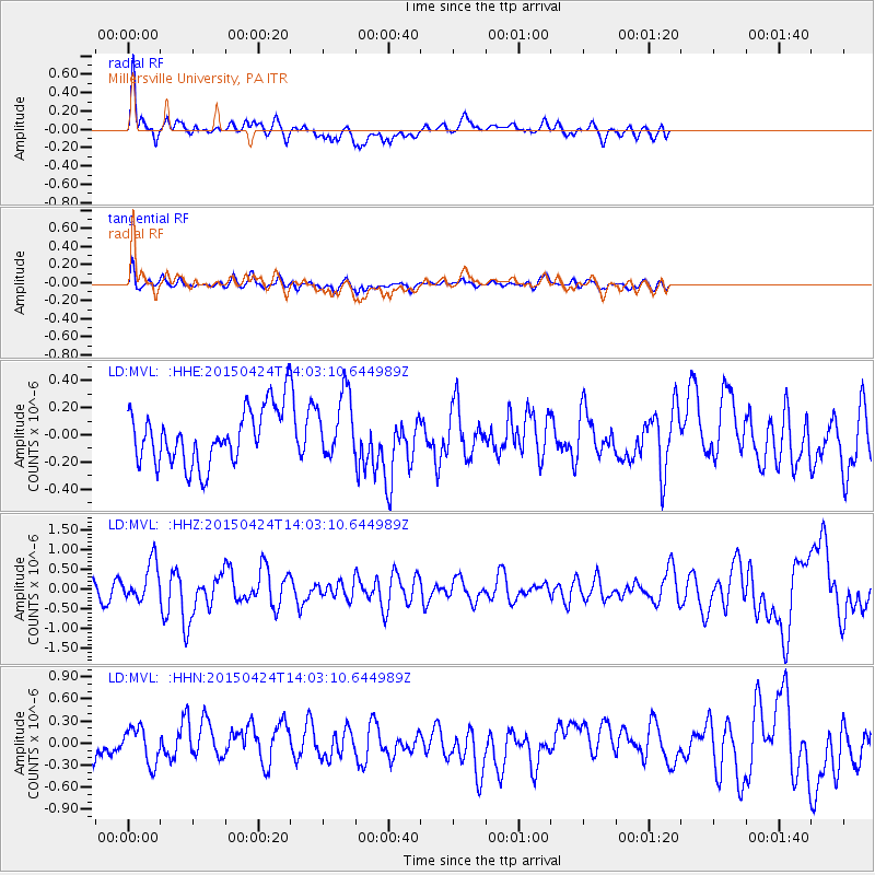
MVL Millersville University, PA - Earthquake Result Viewer
*The percent match for this event was below the threshold and hence no stack was calculated.
| Earthquake location: |
Queen Charlotte Islands Region |
| Earthquake latitude/longitude: |
51.7/-130.8 |
| Earthquake time(UTC): |
2015/04/24 (114) 13:56:16 GMT |
| Earthquake Depth: |
10 km |
| Earthquake Magnitude: |
6.1 MO |
| Earthquake Catalog/Contributor: |
NEIC PDE/NEIC ALERT |
|
| Network: |
LD Lamont-Doherty Cooperative Seismographic Network |
| Station: |
MVL Millersville University, PA |
| Lat/Lon: |
40.00 N/76.35 W |
| Elevation: |
91 m |
|
| Distance: |
38.8 deg |
| Az: |
85.612 deg |
| Baz: |
306.185 deg |
| Ray Param: |
$rayparam |
*The percent match for this event was below the threshold and hence was not used in the summary stack. |
|
| Radial Match: |
71.37703 % |
| Radial Bump: |
400 |
| Transverse Match: |
53.67737 % |
| Transverse Bump: |
400 |
| SOD ConfigId: |
7422571 |
| Insert Time: |
2019-04-18 08:24:34.932 +0000 |
| GWidth: |
2.5 |
| Max Bumps: |
400 |
| Tol: |
0.001 |
|
Signal To Noise
| Channel | StoN | STA | LTA |
| LD:MVL: :HHZ:20150424T14:03:10.644989Z | 3.3703158 | 4.871512E-7 | 1.4454172E-7 |
| LD:MVL: :HHN:20150424T14:03:10.644989Z | 0.8171583 | 2.445362E-7 | 2.9925195E-7 |
| LD:MVL: :HHE:20150424T14:03:10.644989Z | 1.3386363 | 2.530296E-7 | 1.8902044E-7 |
| Arrivals |
| Ps | |
| PpPs | |
| PsPs/PpSs | |


