You are here: Home > Network List > US - United States National Seismic Network Stations List
> Station CBKS Cedar Bluff, Kansas, USA > Earthquake Result Viewer
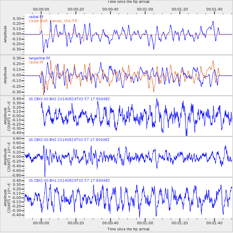
CBKS Cedar Bluff, Kansas, USA - Earthquake Result Viewer
*The percent match for this event was below the threshold and hence no stack was calculated.
| Earthquake location: |
Southern Greece |
| Earthquake latitude/longitude: |
36.7/23.8 |
| Earthquake time(UTC): |
2014/08/29 (241) 03:45:06 GMT |
| Earthquake Depth: |
92 km |
| Earthquake Magnitude: |
5.6 MB |
| Earthquake Catalog/Contributor: |
NEIC PDE/NEIC COMCAT |
|
| Network: |
US United States National Seismic Network |
| Station: |
CBKS Cedar Bluff, Kansas, USA |
| Lat/Lon: |
38.81 N/99.74 W |
| Elevation: |
677 m |
|
| Distance: |
88.5 deg |
| Az: |
319.329 deg |
| Baz: |
42.076 deg |
| Ray Param: |
$rayparam |
*The percent match for this event was below the threshold and hence was not used in the summary stack. |
|
| Radial Match: |
53.85404 % |
| Radial Bump: |
400 |
| Transverse Match: |
44.03203 % |
| Transverse Bump: |
400 |
| SOD ConfigId: |
769524 |
| Insert Time: |
2014-09-12 04:16:57.223 +0000 |
| GWidth: |
2.5 |
| Max Bumps: |
400 |
| Tol: |
0.001 |
|
Signal To Noise
| Channel | StoN | STA | LTA |
| US:CBKS:00:BHZ:20140829T03:57:17.89998Z | 2.54051 | 2.5891376E-7 | 1.0191409E-7 |
| US:CBKS:00:BH1:20140829T03:57:17.89998Z | 1.4519281 | 1.8383282E-7 | 1.2661289E-7 |
| US:CBKS:00:BH2:20140829T03:57:17.89998Z | 1.3068776 | 1.5286429E-7 | 1.1696909E-7 |
| Arrivals |
| Ps | |
| PpPs | |
| PsPs/PpSs | |


