You are here: Home > Network List > CN - Canadian National Seismograph Network Stations List
> Station INK INUVIK, NT > Earthquake Result Viewer
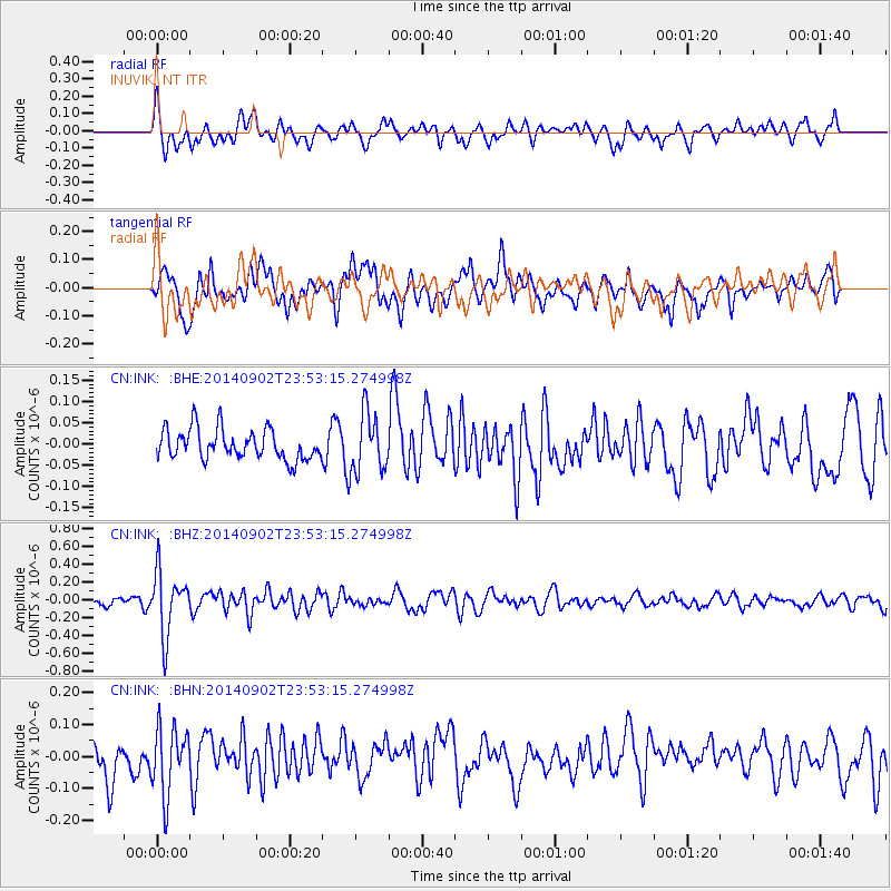
INK INUVIK, NT - Earthquake Result Viewer
*The percent match for this event was below the threshold and hence no stack was calculated.
| Earthquake location: |
Central East Pacific Rise |
| Earthquake latitude/longitude: |
-11.6/-112.0 |
| Earthquake time(UTC): |
2014/09/02 (245) 23:41:31 GMT |
| Earthquake Depth: |
10 km |
| Earthquake Magnitude: |
5.5 MWP |
| Earthquake Catalog/Contributor: |
NEIC PDE/NEIC COMCAT |
|
| Network: |
CN Canadian National Seismograph Network |
| Station: |
INK INUVIK, NT |
| Lat/Lon: |
68.31 N/133.53 W |
| Elevation: |
44 m |
|
| Distance: |
81.2 deg |
| Az: |
352.068 deg |
| Baz: |
158.672 deg |
| Ray Param: |
$rayparam |
*The percent match for this event was below the threshold and hence was not used in the summary stack. |
|
| Radial Match: |
60.60564 % |
| Radial Bump: |
400 |
| Transverse Match: |
60.40134 % |
| Transverse Bump: |
400 |
| SOD ConfigId: |
769524 |
| Insert Time: |
2014-09-17 00:12:45.897 +0000 |
| GWidth: |
2.5 |
| Max Bumps: |
400 |
| Tol: |
0.001 |
|
Signal To Noise
| Channel | StoN | STA | LTA |
| CN:INK: :BHZ:20140902T23:53:15.274998Z | 6.028935 | 3.5365278E-7 | 5.8659246E-8 |
| CN:INK: :BHN:20140902T23:53:15.274998Z | 2.2190065 | 1.0565939E-7 | 4.761563E-8 |
| CN:INK: :BHE:20140902T23:53:15.274998Z | 1.9688717 | 7.0176874E-8 | 3.5643193E-8 |
| Arrivals |
| Ps | |
| PpPs | |
| PsPs/PpSs | |


