You are here: Home > Network List > TA - USArray Transportable Network (new EarthScope stations) Stations List
> Station T57A Hurt, VA, USA > Earthquake Result Viewer
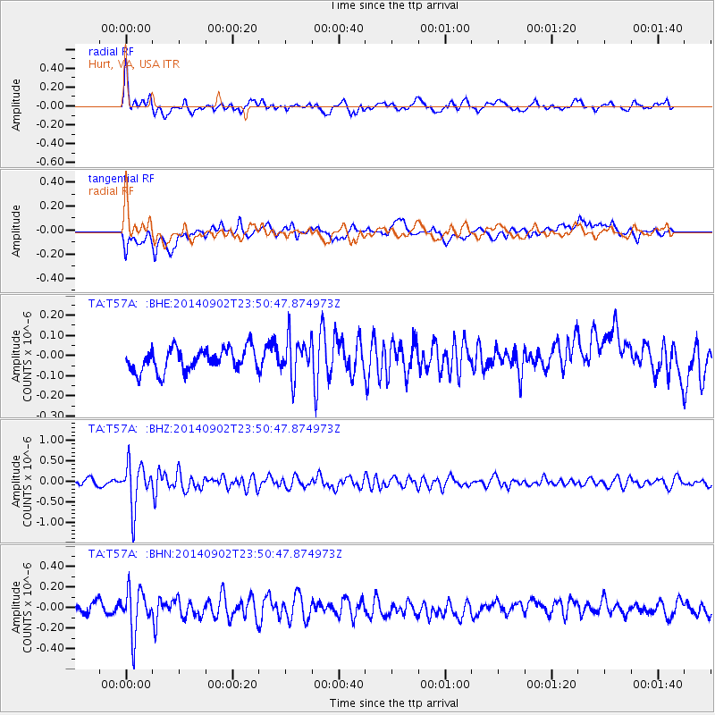
T57A Hurt, VA, USA - Earthquake Result Viewer
*The percent match for this event was below the threshold and hence no stack was calculated.
| Earthquake location: |
Central East Pacific Rise |
| Earthquake latitude/longitude: |
-11.6/-112.0 |
| Earthquake time(UTC): |
2014/09/02 (245) 23:41:31 GMT |
| Earthquake Depth: |
10 km |
| Earthquake Magnitude: |
5.5 MWP |
| Earthquake Catalog/Contributor: |
NEIC PDE/NEIC COMCAT |
|
| Network: |
TA USArray Transportable Network (new EarthScope stations) |
| Station: |
T57A Hurt, VA, USA |
| Lat/Lon: |
37.00 N/79.25 W |
| Elevation: |
230 m |
|
| Distance: |
57.3 deg |
| Az: |
30.981 deg |
| Baz: |
219.053 deg |
| Ray Param: |
$rayparam |
*The percent match for this event was below the threshold and hence was not used in the summary stack. |
|
| Radial Match: |
76.52802 % |
| Radial Bump: |
400 |
| Transverse Match: |
49.984524 % |
| Transverse Bump: |
400 |
| SOD ConfigId: |
769524 |
| Insert Time: |
2014-09-17 00:49:55.305 +0000 |
| GWidth: |
2.5 |
| Max Bumps: |
400 |
| Tol: |
0.001 |
|
Signal To Noise
| Channel | StoN | STA | LTA |
| TA:T57A: :BHZ:20140902T23:50:47.874973Z | 10.50321 | 5.39168E-7 | 5.1333643E-8 |
| TA:T57A: :BHN:20140902T23:50:47.874973Z | 4.638408 | 2.160361E-7 | 4.6575483E-8 |
| TA:T57A: :BHE:20140902T23:50:47.874973Z | 1.7179983 | 9.576454E-8 | 5.5741932E-8 |
| Arrivals |
| Ps | |
| PpPs | |
| PsPs/PpSs | |


