You are here: Home > Network List > TA - USArray Transportable Network (new EarthScope stations) Stations List
> Station V56A Mocksville, NC, USA > Earthquake Result Viewer
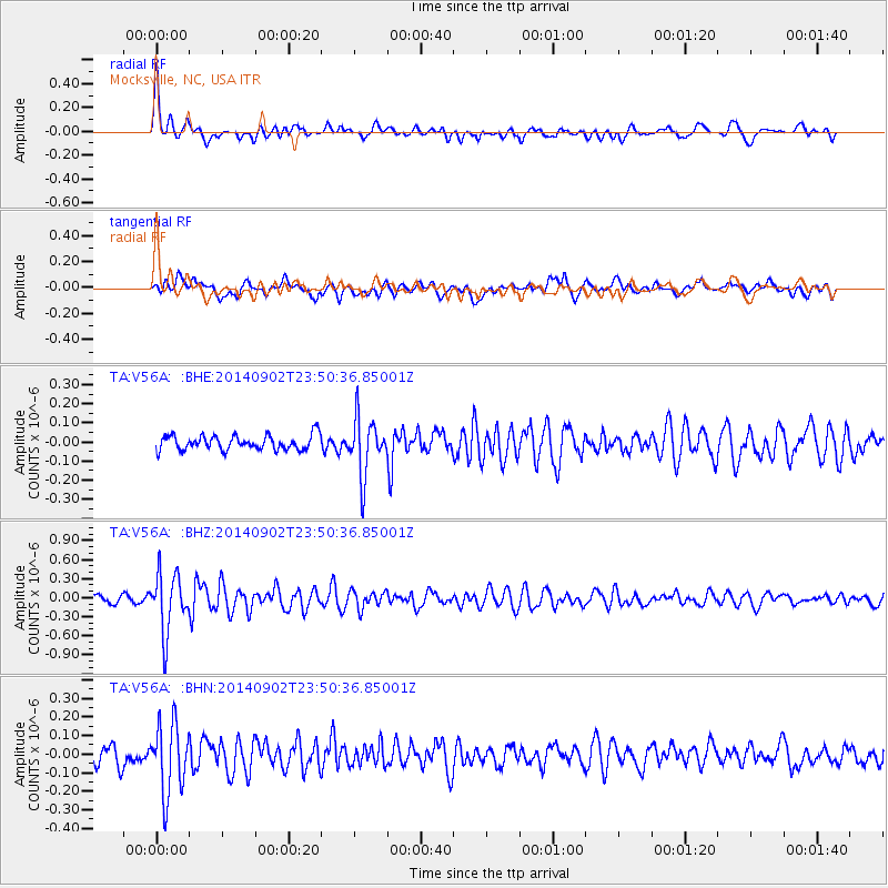
V56A Mocksville, NC, USA - Earthquake Result Viewer
*The percent match for this event was below the threshold and hence no stack was calculated.
| Earthquake location: |
Central East Pacific Rise |
| Earthquake latitude/longitude: |
-11.6/-112.0 |
| Earthquake time(UTC): |
2014/09/02 (245) 23:41:31 GMT |
| Earthquake Depth: |
10 km |
| Earthquake Magnitude: |
5.5 MWP |
| Earthquake Catalog/Contributor: |
NEIC PDE/NEIC COMCAT |
|
| Network: |
TA USArray Transportable Network (new EarthScope stations) |
| Station: |
V56A Mocksville, NC, USA |
| Lat/Lon: |
35.81 N/80.50 W |
| Elevation: |
237 m |
|
| Distance: |
55.7 deg |
| Az: |
30.931 deg |
| Baz: |
218.292 deg |
| Ray Param: |
$rayparam |
*The percent match for this event was below the threshold and hence was not used in the summary stack. |
|
| Radial Match: |
79.082924 % |
| Radial Bump: |
400 |
| Transverse Match: |
67.94778 % |
| Transverse Bump: |
400 |
| SOD ConfigId: |
769524 |
| Insert Time: |
2014-09-17 00:50:39.427 +0000 |
| GWidth: |
2.5 |
| Max Bumps: |
400 |
| Tol: |
0.001 |
|
Signal To Noise
| Channel | StoN | STA | LTA |
| TA:V56A: :BHZ:20140902T23:50:36.85001Z | 5.0885177 | 4.657163E-7 | 9.1522985E-8 |
| TA:V56A: :BHN:20140902T23:50:36.85001Z | 3.2991176 | 1.9220975E-7 | 5.826096E-8 |
| TA:V56A: :BHE:20140902T23:50:36.85001Z | 3.968959 | 1.5146415E-7 | 3.8162185E-8 |
| Arrivals |
| Ps | |
| PpPs | |
| PsPs/PpSs | |


