You are here: Home > Network List > UW - Pacific Northwest Regional Seismic Network Stations List
> Station MRBL Marblemount, WA, USA > Earthquake Result Viewer
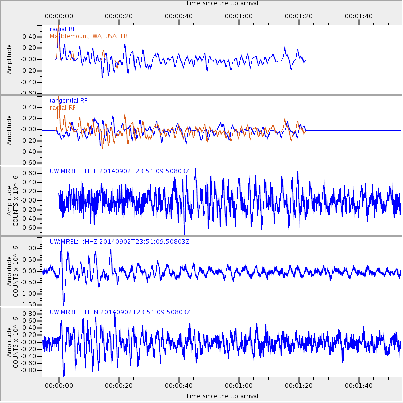
MRBL Marblemount, WA, USA - Earthquake Result Viewer
*The percent match for this event was below the threshold and hence no stack was calculated.
| Earthquake location: |
Central East Pacific Rise |
| Earthquake latitude/longitude: |
-11.6/-112.0 |
| Earthquake time(UTC): |
2014/09/02 (245) 23:41:31 GMT |
| Earthquake Depth: |
10 km |
| Earthquake Magnitude: |
5.5 MWP |
| Earthquake Catalog/Contributor: |
NEIC PDE/NEIC COMCAT |
|
| Network: |
UW Pacific Northwest Regional Seismic Network |
| Station: |
MRBL Marblemount, WA, USA |
| Lat/Lon: |
48.52 N/121.48 W |
| Elevation: |
75 m |
|
| Distance: |
60.4 deg |
| Az: |
352.771 deg |
| Baz: |
169.312 deg |
| Ray Param: |
$rayparam |
*The percent match for this event was below the threshold and hence was not used in the summary stack. |
|
| Radial Match: |
76.1048 % |
| Radial Bump: |
400 |
| Transverse Match: |
76.52908 % |
| Transverse Bump: |
400 |
| SOD ConfigId: |
769524 |
| Insert Time: |
2014-09-17 01:01:37.180 +0000 |
| GWidth: |
2.5 |
| Max Bumps: |
400 |
| Tol: |
0.001 |
|
Signal To Noise
| Channel | StoN | STA | LTA |
| UW:MRBL: :HHZ:20140902T23:51:09.50803Z | 6.4612403 | 6.208246E-7 | 9.608443E-8 |
| UW:MRBL: :HHN:20140902T23:51:09.50803Z | 2.5871005 | 3.5832937E-7 | 1.3850617E-7 |
| UW:MRBL: :HHE:20140902T23:51:09.50803Z | 0.9661723 | 1.5726931E-7 | 1.6277565E-7 |
| Arrivals |
| Ps | |
| PpPs | |
| PsPs/PpSs | |


