You are here: Home > Network List > US - United States National Seismic Network Stations List
> Station HAWA Hanford, Washington, USA > Earthquake Result Viewer
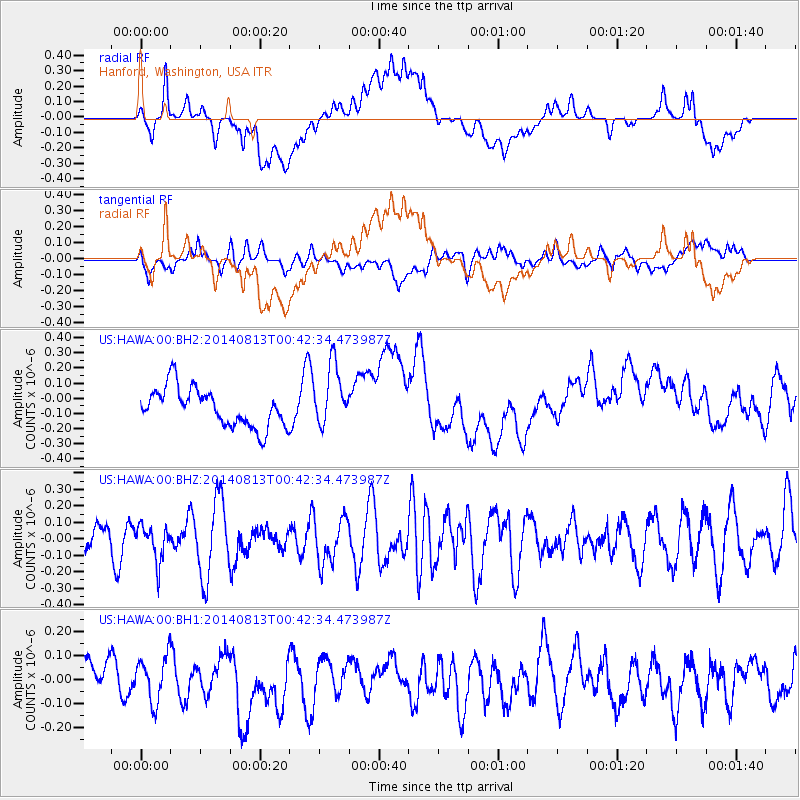
HAWA Hanford, Washington, USA - Earthquake Result Viewer
*The percent match for this event was below the threshold and hence no stack was calculated.
| Earthquake location: |
Mariana Islands |
| Earthquake latitude/longitude: |
13.9/145.0 |
| Earthquake time(UTC): |
2014/08/13 (225) 00:30:47 GMT |
| Earthquake Depth: |
98 km |
| Earthquake Magnitude: |
5.6 MWW, 5.6 MWC, 5.6 MWB |
| Earthquake Catalog/Contributor: |
NEIC PDE/NEIC COMCAT |
|
| Network: |
US United States National Seismic Network |
| Station: |
HAWA Hanford, Washington, USA |
| Lat/Lon: |
46.39 N/119.53 W |
| Elevation: |
364 m |
|
| Distance: |
83.8 deg |
| Az: |
43.871 deg |
| Baz: |
283.518 deg |
| Ray Param: |
$rayparam |
*The percent match for this event was below the threshold and hence was not used in the summary stack. |
|
| Radial Match: |
38.416286 % |
| Radial Bump: |
400 |
| Transverse Match: |
40.72124 % |
| Transverse Bump: |
400 |
| SOD ConfigId: |
769524 |
| Insert Time: |
2014-09-17 05:48:01.879 +0000 |
| GWidth: |
2.5 |
| Max Bumps: |
400 |
| Tol: |
0.001 |
|
Signal To Noise
| Channel | StoN | STA | LTA |
| US:HAWA:00:BHZ:20140813T00:42:34.473987Z | 0.9713655 | 1.0897118E-7 | 1.121835E-7 |
| US:HAWA:00:BH1:20140813T00:42:34.473987Z | 1.3058186 | 9.501158E-8 | 7.2760166E-8 |
| US:HAWA:00:BH2:20140813T00:42:34.473987Z | 1.6073734 | 2.029477E-7 | 1.2626046E-7 |
| Arrivals |
| Ps | |
| PpPs | |
| PsPs/PpSs | |


