You are here: Home > Network List > IU - Global Seismograph Network (GSN - IRIS/USGS) Stations List
> Station POHA Pohakuloa, Hawaii, USA > Earthquake Result Viewer
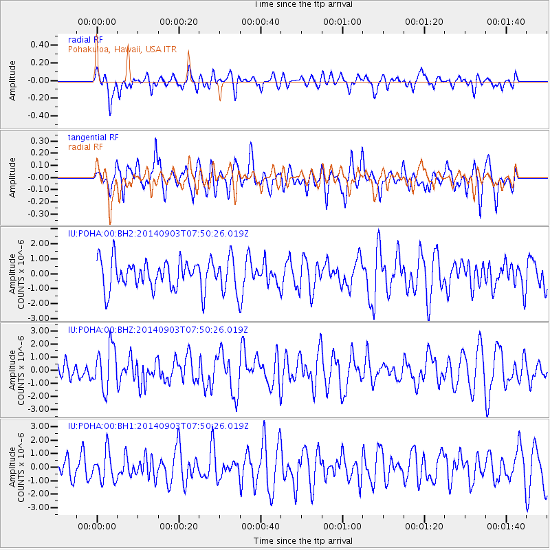
POHA Pohakuloa, Hawaii, USA - Earthquake Result Viewer
*The percent match for this event was below the threshold and hence no stack was calculated.
| Earthquake location: |
Tonga Islands |
| Earthquake latitude/longitude: |
-15.0/-173.5 |
| Earthquake time(UTC): |
2014/09/03 (246) 07:43:31 GMT |
| Earthquake Depth: |
10 km |
| Earthquake Magnitude: |
5.7 MB |
| Earthquake Catalog/Contributor: |
NEIC PDE/NEIC COMCAT |
|
| Network: |
IU Global Seismograph Network (GSN - IRIS/USGS) |
| Station: |
POHA Pohakuloa, Hawaii, USA |
| Lat/Lon: |
19.76 N/155.53 W |
| Elevation: |
1990 m |
|
| Distance: |
38.8 deg |
| Az: |
27.64 deg |
| Baz: |
208.422 deg |
| Ray Param: |
$rayparam |
*The percent match for this event was below the threshold and hence was not used in the summary stack. |
|
| Radial Match: |
42.208023 % |
| Radial Bump: |
400 |
| Transverse Match: |
50.242966 % |
| Transverse Bump: |
400 |
| SOD ConfigId: |
769524 |
| Insert Time: |
2014-09-17 08:43:00.085 +0000 |
| GWidth: |
2.5 |
| Max Bumps: |
400 |
| Tol: |
0.001 |
|
Signal To Noise
| Channel | StoN | STA | LTA |
| IU:POHA:00:BHZ:20140903T07:50:26.019Z | 2.5175848 | 1.6686885E-6 | 6.628132E-7 |
| IU:POHA:00:BH1:20140903T07:50:26.019Z | 1.1983007 | 1.1219554E-6 | 9.362887E-7 |
| IU:POHA:00:BH2:20140903T07:50:26.019Z | 1.339796 | 1.1939077E-6 | 8.911116E-7 |
| Arrivals |
| Ps | |
| PpPs | |
| PsPs/PpSs | |


