You are here: Home > Network List > US - United States National Seismic Network Stations List
> Station AMTX Amarillo, Texas, USA > Earthquake Result Viewer
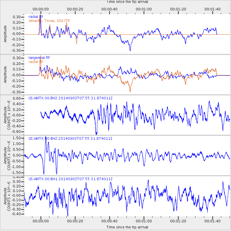
AMTX Amarillo, Texas, USA - Earthquake Result Viewer
*The percent match for this event was below the threshold and hence no stack was calculated.
| Earthquake location: |
Tonga Islands |
| Earthquake latitude/longitude: |
-15.0/-173.5 |
| Earthquake time(UTC): |
2014/09/03 (246) 07:43:31 GMT |
| Earthquake Depth: |
10 km |
| Earthquake Magnitude: |
5.7 MB |
| Earthquake Catalog/Contributor: |
NEIC PDE/NEIC COMCAT |
|
| Network: |
US United States National Seismic Network |
| Station: |
AMTX Amarillo, Texas, USA |
| Lat/Lon: |
34.53 N/101.41 W |
| Elevation: |
1010 m |
|
| Distance: |
84.3 deg |
| Az: |
52.149 deg |
| Baz: |
247.55 deg |
| Ray Param: |
$rayparam |
*The percent match for this event was below the threshold and hence was not used in the summary stack. |
|
| Radial Match: |
53.201828 % |
| Radial Bump: |
400 |
| Transverse Match: |
47.303448 % |
| Transverse Bump: |
400 |
| SOD ConfigId: |
769524 |
| Insert Time: |
2014-09-17 09:03:13.251 +0000 |
| GWidth: |
2.5 |
| Max Bumps: |
400 |
| Tol: |
0.001 |
|
Signal To Noise
| Channel | StoN | STA | LTA |
| US:AMTX:00:BHZ:20140903T07:55:31.874011Z | 9.192294 | 8.128344E-7 | 8.842564E-8 |
| US:AMTX:00:BH1:20140903T07:55:31.874011Z | 0.6188705 | 6.963998E-8 | 1.1252755E-7 |
| US:AMTX:00:BH2:20140903T07:55:31.874011Z | 2.5239515 | 3.034615E-7 | 1.202327E-7 |
| Arrivals |
| Ps | |
| PpPs | |
| PsPs/PpSs | |


