You are here: Home > Network List > UW - Pacific Northwest Regional Seismic Network Stations List
> Station MRBL Marblemount, WA, USA > Earthquake Result Viewer
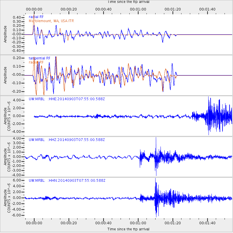
MRBL Marblemount, WA, USA - Earthquake Result Viewer
*The percent match for this event was below the threshold and hence no stack was calculated.
| Earthquake location: |
Tonga Islands |
| Earthquake latitude/longitude: |
-15.0/-173.5 |
| Earthquake time(UTC): |
2014/09/03 (246) 07:43:31 GMT |
| Earthquake Depth: |
10 km |
| Earthquake Magnitude: |
5.7 MB |
| Earthquake Catalog/Contributor: |
NEIC PDE/NEIC COMCAT |
|
| Network: |
UW Pacific Northwest Regional Seismic Network |
| Station: |
MRBL Marblemount, WA, USA |
| Lat/Lon: |
48.52 N/121.48 W |
| Elevation: |
75 m |
|
| Distance: |
78.3 deg |
| Az: |
32.364 deg |
| Baz: |
231.078 deg |
| Ray Param: |
$rayparam |
*The percent match for this event was below the threshold and hence was not used in the summary stack. |
|
| Radial Match: |
61.189613 % |
| Radial Bump: |
400 |
| Transverse Match: |
61.438854 % |
| Transverse Bump: |
400 |
| SOD ConfigId: |
769524 |
| Insert Time: |
2014-09-17 09:06:19.959 +0000 |
| GWidth: |
2.5 |
| Max Bumps: |
400 |
| Tol: |
0.001 |
|
Signal To Noise
| Channel | StoN | STA | LTA |
| UW:MRBL: :HHZ:20140903T07:55:00.588Z | 1.9618906 | 3.3418704E-7 | 1.7033928E-7 |
| UW:MRBL: :HHN:20140903T07:55:00.588Z | 0.923172 | 1.1640501E-7 | 1.2609243E-7 |
| UW:MRBL: :HHE:20140903T07:55:00.588Z | 1.0079138 | 1.0884267E-7 | 1.0798807E-7 |
| Arrivals |
| Ps | |
| PpPs | |
| PsPs/PpSs | |


