You are here: Home > Network List > IU - Global Seismograph Network (GSN - IRIS/USGS) Stations List
> Station SLBS Sierra la Laguna Baja California Sur, Mexico > Earthquake Result Viewer
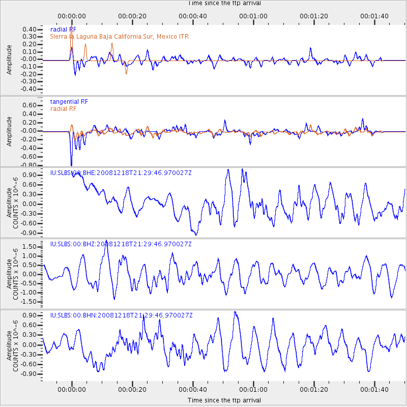
SLBS Sierra la Laguna Baja California Sur, Mexico - Earthquake Result Viewer
*The percent match for this event was below the threshold and hence no stack was calculated.
| Earthquake location: |
Near Coast Of Central Chile |
| Earthquake latitude/longitude: |
-32.5/-71.7 |
| Earthquake time(UTC): |
2008/12/18 (353) 21:19:28 GMT |
| Earthquake Depth: |
18 km |
| Earthquake Magnitude: |
5.8 MB, 6.0 MS, 6.2 MW, 6.1 MW |
| Earthquake Catalog/Contributor: |
WHDF/NEIC |
|
| Network: |
IU Global Seismograph Network (GSN - IRIS/USGS) |
| Station: |
SLBS Sierra la Laguna Baja California Sur, Mexico |
| Lat/Lon: |
23.69 N/109.94 W |
| Elevation: |
825 m |
|
| Distance: |
66.7 deg |
| Az: |
321.865 deg |
| Baz: |
145.287 deg |
| Ray Param: |
$rayparam |
*The percent match for this event was below the threshold and hence was not used in the summary stack. |
|
| Radial Match: |
44.856876 % |
| Radial Bump: |
400 |
| Transverse Match: |
60.444534 % |
| Transverse Bump: |
363 |
| SOD ConfigId: |
2658 |
| Insert Time: |
2010-03-02 01:21:49.778 +0000 |
| GWidth: |
2.5 |
| Max Bumps: |
400 |
| Tol: |
0.001 |
|
Signal To Noise
| Channel | StoN | STA | LTA |
| IU:SLBS:00:BHZ:20081218T21:29:46.970027Z | 1.9789033 | 7.082908E-7 | 3.5792087E-7 |
| IU:SLBS:00:BHN:20081218T21:29:46.970027Z | 0.98876244 | 3.970041E-7 | 4.0151616E-7 |
| IU:SLBS:00:BHE:20081218T21:29:46.970027Z | 1.0323355 | 3.8629045E-7 | 3.741908E-7 |
| Arrivals |
| Ps | |
| PpPs | |
| PsPs/PpSs | |


