You are here: Home > Network List > UW - Pacific Northwest Regional Seismic Network Stations List
> Station MRBL Marblemount, WA, USA > Earthquake Result Viewer
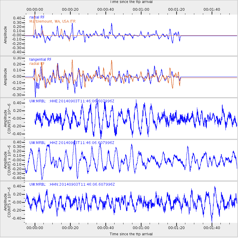
MRBL Marblemount, WA, USA - Earthquake Result Viewer
*The percent match for this event was below the threshold and hence no stack was calculated.
| Earthquake location: |
Samoa Islands |
| Earthquake latitude/longitude: |
-14.9/-172.9 |
| Earthquake time(UTC): |
2014/09/03 (246) 11:34:40 GMT |
| Earthquake Depth: |
10 km |
| Earthquake Magnitude: |
5.7 MWW, 5.7 MWC, 5.7 MWB |
| Earthquake Catalog/Contributor: |
NEIC PDE/NEIC COMCAT |
|
| Network: |
UW Pacific Northwest Regional Seismic Network |
| Station: |
MRBL Marblemount, WA, USA |
| Lat/Lon: |
48.52 N/121.48 W |
| Elevation: |
75 m |
|
| Distance: |
77.9 deg |
| Az: |
32.112 deg |
| Baz: |
230.615 deg |
| Ray Param: |
$rayparam |
*The percent match for this event was below the threshold and hence was not used in the summary stack. |
|
| Radial Match: |
59.945045 % |
| Radial Bump: |
400 |
| Transverse Match: |
48.665478 % |
| Transverse Bump: |
400 |
| SOD ConfigId: |
769524 |
| Insert Time: |
2014-09-17 12:13:11.501 +0000 |
| GWidth: |
2.5 |
| Max Bumps: |
400 |
| Tol: |
0.001 |
|
Signal To Noise
| Channel | StoN | STA | LTA |
| UW:MRBL: :HHZ:20140903T11:46:06.607996Z | 1.075358 | 2.2430865E-7 | 2.0858974E-7 |
| UW:MRBL: :HHN:20140903T11:46:06.607996Z | 0.91135883 | 1.2317389E-7 | 1.351541E-7 |
| UW:MRBL: :HHE:20140903T11:46:06.607996Z | 2.2794468 | 2.5454156E-7 | 1.1166813E-7 |
| Arrivals |
| Ps | |
| PpPs | |
| PsPs/PpSs | |


