You are here: Home > Network List > AV - Alaska Volcano Observatory Stations List
> Station SPCR Ckakachatna River, Mount Spurr, Alaska > Earthquake Result Viewer
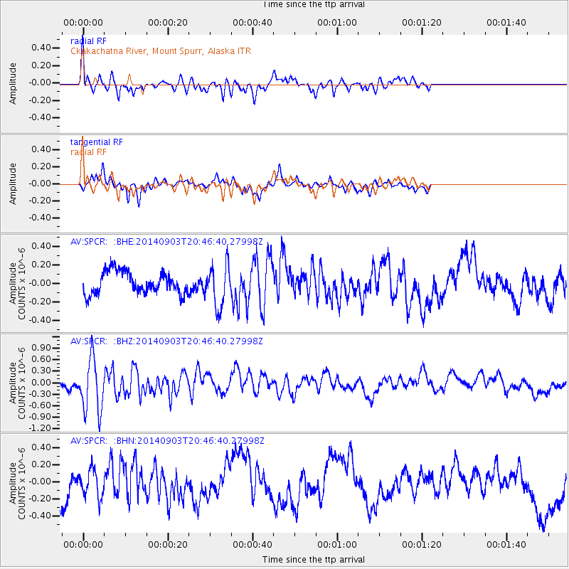
SPCR Ckakachatna River, Mount Spurr, Alaska - Earthquake Result Viewer
*The percent match for this event was below the threshold and hence no stack was calculated.
| Earthquake location: |
Easter Island Region |
| Earthquake latitude/longitude: |
-26.5/-114.6 |
| Earthquake time(UTC): |
2014/09/03 (246) 20:34:00 GMT |
| Earthquake Depth: |
10 km |
| Earthquake Magnitude: |
5.9 MWB |
| Earthquake Catalog/Contributor: |
NEIC PDE/NEIC COMCAT |
|
| Network: |
AV Alaska Volcano Observatory |
| Station: |
SPCR Ckakachatna River, Mount Spurr, Alaska |
| Lat/Lon: |
61.20 N/152.21 W |
| Elevation: |
984 m |
|
| Distance: |
92.6 deg |
| Az: |
342.805 deg |
| Baz: |
146.848 deg |
| Ray Param: |
$rayparam |
*The percent match for this event was below the threshold and hence was not used in the summary stack. |
|
| Radial Match: |
61.455555 % |
| Radial Bump: |
400 |
| Transverse Match: |
45.13441 % |
| Transverse Bump: |
329 |
| SOD ConfigId: |
769524 |
| Insert Time: |
2014-09-17 20:43:10.392 +0000 |
| GWidth: |
2.5 |
| Max Bumps: |
400 |
| Tol: |
0.001 |
|
Signal To Noise
| Channel | StoN | STA | LTA |
| AV:SPCR: :BHZ:20140903T20:46:40.27998Z | 4.7493353 | 7.04806E-7 | 1.4840099E-7 |
| AV:SPCR: :BHN:20140903T20:46:40.27998Z | 0.93272084 | 1.6671781E-7 | 1.7874352E-7 |
| AV:SPCR: :BHE:20140903T20:46:40.27998Z | 1.9738585 | 2.3186173E-7 | 1.1746624E-7 |
| Arrivals |
| Ps | |
| PpPs | |
| PsPs/PpSs | |


