You are here: Home > Network List > CN - Canadian National Seismograph Network Stations List
> Station INK INUVIK, NT > Earthquake Result Viewer
INK INUVIK, NT - Earthquake Result Viewer
*The percent match for this event was below the threshold and hence no stack was calculated.
| Earthquake location: |
Easter Island Region |
| Earthquake latitude/longitude: |
-26.5/-114.6 |
| Earthquake time(UTC): |
2014/09/03 (246) 20:34:00 GMT |
| Earthquake Depth: |
10 km |
| Earthquake Magnitude: |
5.9 MWB |
| Earthquake Catalog/Contributor: |
NEIC PDE/NEIC COMCAT |
|
| Network: |
CN Canadian National Seismograph Network |
| Station: |
INK INUVIK, NT |
| Lat/Lon: |
68.31 N/133.53 W |
| Elevation: |
44 m |
|
| Distance: |
95.6 deg |
| Az: |
353.051 deg |
| Baz: |
163.052 deg |
| Ray Param: |
$rayparam |
*The percent match for this event was below the threshold and hence was not used in the summary stack. |
|
| Radial Match: |
56.54381 % |
| Radial Bump: |
400 |
| Transverse Match: |
51.183514 % |
| Transverse Bump: |
400 |
| SOD ConfigId: |
769524 |
| Insert Time: |
2014-09-17 20:49:16.490 +0000 |
| GWidth: |
2.5 |
| Max Bumps: |
400 |
| Tol: |
0.001 |
|
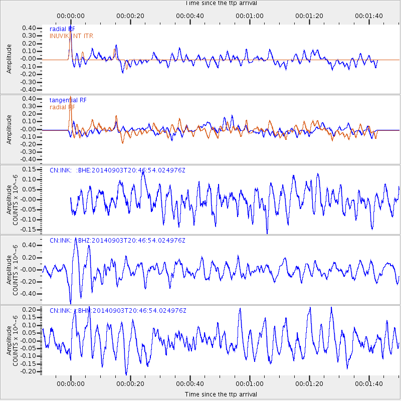
Signal To Noise
| Channel | StoN | STA | LTA |
| CN:INK: :BHZ:20140903T20:46:54.024976Z | 6.636173 | 3.2328188E-7 | 4.871511E-8 |
| CN:INK: :BHN:20140903T20:46:54.024976Z | 2.288211 | 9.6300866E-8 | 4.2085652E-8 |
| CN:INK: :BHE:20140903T20:46:54.024976Z | 1.2122252 | 6.1299275E-8 | 5.0567564E-8 |
| Arrivals |
| Ps | |
| PpPs | |
| PsPs/PpSs | |


