You are here: Home > Network List > TA - USArray Transportable Network (new EarthScope stations) Stations List
> Station G65A Princeton, ME, USA > Earthquake Result Viewer
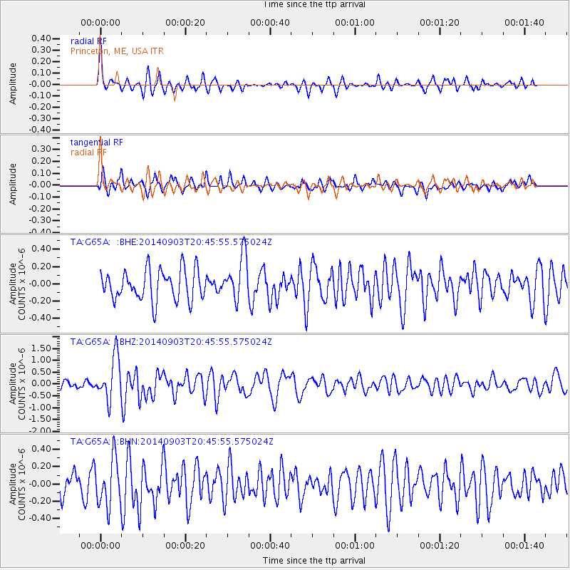
G65A Princeton, ME, USA - Earthquake Result Viewer
*The percent match for this event was below the threshold and hence no stack was calculated.
| Earthquake location: |
Easter Island Region |
| Earthquake latitude/longitude: |
-26.5/-114.6 |
| Earthquake time(UTC): |
2014/09/03 (246) 20:34:00 GMT |
| Earthquake Depth: |
10 km |
| Earthquake Magnitude: |
5.9 MWB |
| Earthquake Catalog/Contributor: |
NEIC PDE/NEIC COMCAT |
|
| Network: |
TA USArray Transportable Network (new EarthScope stations) |
| Station: |
G65A Princeton, ME, USA |
| Lat/Lon: |
45.20 N/67.56 W |
| Elevation: |
78 m |
|
| Distance: |
83.3 deg |
| Az: |
31.413 deg |
| Baz: |
221.326 deg |
| Ray Param: |
$rayparam |
*The percent match for this event was below the threshold and hence was not used in the summary stack. |
|
| Radial Match: |
68.160385 % |
| Radial Bump: |
371 |
| Transverse Match: |
53.346497 % |
| Transverse Bump: |
400 |
| SOD ConfigId: |
790520 |
| Insert Time: |
2014-09-17 21:19:29.086 +0000 |
| GWidth: |
2.5 |
| Max Bumps: |
400 |
| Tol: |
0.001 |
|
Signal To Noise
| Channel | StoN | STA | LTA |
| TA:G65A: :BHZ:20140903T20:45:55.575024Z | 5.176088 | 9.417051E-7 | 1.8193376E-7 |
| TA:G65A: :BHN:20140903T20:45:55.575024Z | 1.7799636 | 2.818859E-7 | 1.5836609E-7 |
| TA:G65A: :BHE:20140903T20:45:55.575024Z | 1.4873395 | 2.600858E-7 | 1.7486649E-7 |
| Arrivals |
| Ps | |
| PpPs | |
| PsPs/PpSs | |


