You are here: Home > Network List > TA - USArray Transportable Network (new EarthScope stations) Stations List
> Station O03E Paynes Creek, CA, USA > Earthquake Result Viewer
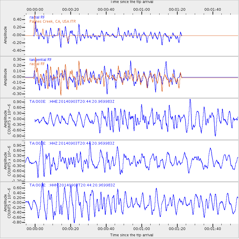
O03E Paynes Creek, CA, USA - Earthquake Result Viewer
*The percent match for this event was below the threshold and hence no stack was calculated.
| Earthquake location: |
Easter Island Region |
| Earthquake latitude/longitude: |
-26.5/-114.6 |
| Earthquake time(UTC): |
2014/09/03 (246) 20:34:00 GMT |
| Earthquake Depth: |
10 km |
| Earthquake Magnitude: |
5.9 MWB |
| Earthquake Catalog/Contributor: |
NEIC PDE/NEIC COMCAT |
|
| Network: |
TA USArray Transportable Network (new EarthScope stations) |
| Station: |
O03E Paynes Creek, CA, USA |
| Lat/Lon: |
40.29 N/121.80 W |
| Elevation: |
967 m |
|
| Distance: |
66.8 deg |
| Az: |
354.037 deg |
| Baz: |
173.012 deg |
| Ray Param: |
$rayparam |
*The percent match for this event was below the threshold and hence was not used in the summary stack. |
|
| Radial Match: |
58.81455 % |
| Radial Bump: |
400 |
| Transverse Match: |
62.484722 % |
| Transverse Bump: |
400 |
| SOD ConfigId: |
790520 |
| Insert Time: |
2014-09-17 21:24:35.120 +0000 |
| GWidth: |
2.5 |
| Max Bumps: |
400 |
| Tol: |
0.001 |
|
Signal To Noise
| Channel | StoN | STA | LTA |
| TA:O03E: :HHZ:20140903T20:44:20.969983Z | 4.625987 | 5.8012955E-7 | 1.2540666E-7 |
| TA:O03E: :HHN:20140903T20:44:20.969983Z | 2.5357919 | 3.932782E-7 | 1.5509089E-7 |
| TA:O03E: :HHE:20140903T20:44:20.969983Z | 1.0965077 | 1.8834778E-7 | 1.7177061E-7 |
| Arrivals |
| Ps | |
| PpPs | |
| PsPs/PpSs | |


