You are here: Home > Network List > UW - Pacific Northwest Regional Seismic Network Stations List
> Station LEBA Lebam, WA, USA > Earthquake Result Viewer
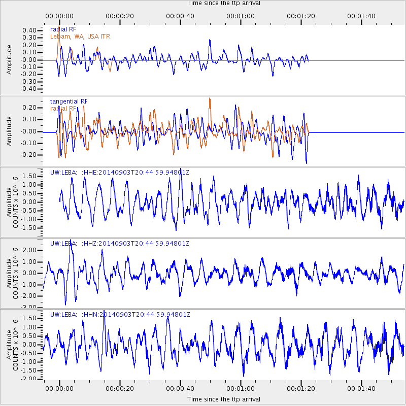
LEBA Lebam, WA, USA - Earthquake Result Viewer
*The percent match for this event was below the threshold and hence no stack was calculated.
| Earthquake location: |
Easter Island Region |
| Earthquake latitude/longitude: |
-26.5/-114.6 |
| Earthquake time(UTC): |
2014/09/03 (246) 20:34:00 GMT |
| Earthquake Depth: |
10 km |
| Earthquake Magnitude: |
5.9 MWB |
| Earthquake Catalog/Contributor: |
NEIC PDE/NEIC COMCAT |
|
| Network: |
UW Pacific Northwest Regional Seismic Network |
| Station: |
LEBA Lebam, WA, USA |
| Lat/Lon: |
46.55 N/123.56 W |
| Elevation: |
73 m |
|
| Distance: |
73.2 deg |
| Az: |
353.571 deg |
| Baz: |
171.644 deg |
| Ray Param: |
$rayparam |
*The percent match for this event was below the threshold and hence was not used in the summary stack. |
|
| Radial Match: |
65.68389 % |
| Radial Bump: |
400 |
| Transverse Match: |
55.639874 % |
| Transverse Bump: |
400 |
| SOD ConfigId: |
790520 |
| Insert Time: |
2014-09-17 21:34:26.882 +0000 |
| GWidth: |
2.5 |
| Max Bumps: |
400 |
| Tol: |
0.001 |
|
Signal To Noise
| Channel | StoN | STA | LTA |
| UW:LEBA: :HHZ:20140903T20:44:59.94801Z | 2.2773776 | 1.3788041E-6 | 6.0543493E-7 |
| UW:LEBA: :HHN:20140903T20:44:59.94801Z | 0.92910445 | 5.697177E-7 | 6.1319014E-7 |
| UW:LEBA: :HHE:20140903T20:44:59.94801Z | 0.70752066 | 5.267148E-7 | 7.4445154E-7 |
| Arrivals |
| Ps | |
| PpPs | |
| PsPs/PpSs | |


