You are here: Home > Network List > AV - Alaska Volcano Observatory Stations List
> Station MAPS Pakushin Southeast, Makushin Volcano, Alaska > Earthquake Result Viewer
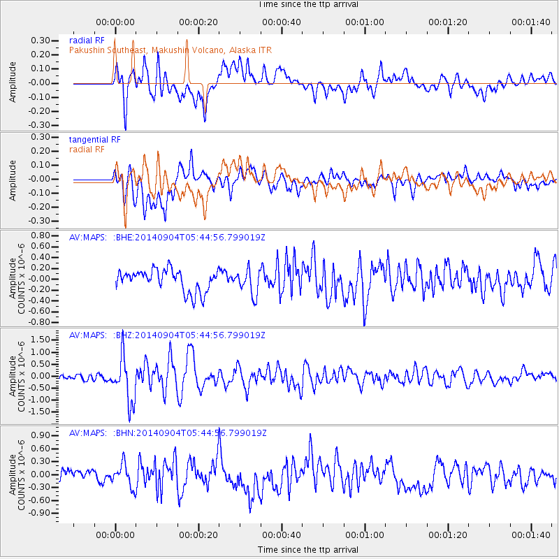
MAPS Pakushin Southeast, Makushin Volcano, Alaska - Earthquake Result Viewer
*The percent match for this event was below the threshold and hence no stack was calculated.
| Earthquake location: |
Tonga Islands |
| Earthquake latitude/longitude: |
-21.4/-173.3 |
| Earthquake time(UTC): |
2014/09/04 (247) 05:33:46 GMT |
| Earthquake Depth: |
12 km |
| Earthquake Magnitude: |
6.0 MWB |
| Earthquake Catalog/Contributor: |
NEIC PDE/NEIC COMCAT |
|
| Network: |
AV Alaska Volcano Observatory |
| Station: |
MAPS Pakushin Southeast, Makushin Volcano, Alaska |
| Lat/Lon: |
53.81 N/166.94 W |
| Elevation: |
333 m |
|
| Distance: |
75.1 deg |
| Az: |
3.872 deg |
| Baz: |
186.091 deg |
| Ray Param: |
$rayparam |
*The percent match for this event was below the threshold and hence was not used in the summary stack. |
|
| Radial Match: |
75.320724 % |
| Radial Bump: |
400 |
| Transverse Match: |
68.420494 % |
| Transverse Bump: |
400 |
| SOD ConfigId: |
790520 |
| Insert Time: |
2014-09-18 05:52:32.212 +0000 |
| GWidth: |
2.5 |
| Max Bumps: |
400 |
| Tol: |
0.001 |
|
Signal To Noise
| Channel | StoN | STA | LTA |
| AV:MAPS: :BHZ:20140904T05:44:56.799019Z | 8.663005 | 9.630272E-7 | 1.111655E-7 |
| AV:MAPS: :BHN:20140904T05:44:56.799019Z | 2.0986705 | 2.82236E-7 | 1.3448323E-7 |
| AV:MAPS: :BHE:20140904T05:44:56.799019Z | 1.199358 | 2.4137015E-7 | 2.0124943E-7 |
| Arrivals |
| Ps | |
| PpPs | |
| PsPs/PpSs | |


