You are here: Home > Network List > TA - USArray Transportable Network (new EarthScope stations) Stations List
> Station N02D Trinity Center, CA, USA > Earthquake Result Viewer
N02D Trinity Center, CA, USA - Earthquake Result Viewer

| Earthquake location: |
Tonga Islands |
| Earthquake latitude/longitude: |
-21.4/-173.3 |
| Earthquake time(UTC): |
2014/09/04 (247) 05:33:46 GMT |
| Earthquake Depth: |
12 km |
| Earthquake Magnitude: |
6.0 MWB |
| Earthquake Catalog/Contributor: |
NEIC PDE/NEIC COMCAT |
|
| Network: |
TA USArray Transportable Network (new EarthScope stations) |
| Station: |
N02D Trinity Center, CA, USA |
| Lat/Lon: |
40.97 N/122.71 W |
| Elevation: |
937 m |
|
| Distance: |
77.8 deg |
| Az: |
36.743 deg |
| Baz: |
227.415 deg |
| Ray Param: |
0.050076276 |
| Estimated Moho Depth: |
40.25 km |
| Estimated Crust Vp/Vs: |
2.09 |
| Assumed Crust Vp: |
6.566 km/s |
| Estimated Crust Vs: |
3.138 km/s |
| Estimated Crust Poisson's Ratio: |
0.35 |
|
| Radial Match: |
82.25632 % |
| Radial Bump: |
400 |
| Transverse Match: |
79.072845 % |
| Transverse Bump: |
394 |
| SOD ConfigId: |
790520 |
| Insert Time: |
2014-09-18 06:12:00.449 +0000 |
| GWidth: |
2.5 |
| Max Bumps: |
400 |
| Tol: |
0.001 |
|
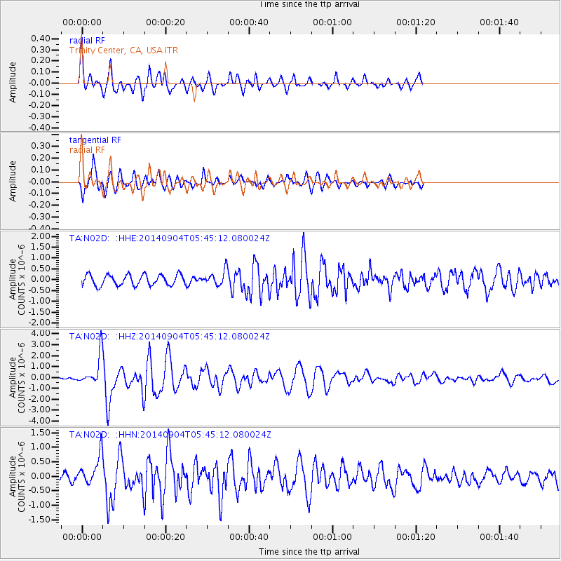
Signal To Noise
| Channel | StoN | STA | LTA |
| TA:N02D: :HHZ:20140904T05:45:12.080024Z | 5.6753526 | 1.39853E-6 | 2.4642168E-7 |
| TA:N02D: :HHN:20140904T05:45:12.080024Z | 2.2522974 | 5.4287517E-7 | 2.4103176E-7 |
| TA:N02D: :HHE:20140904T05:45:12.080024Z | 1.3932238 | 3.4339894E-7 | 2.4647795E-7 |
| Arrivals |
| Ps | 6.9 SECOND |
| PpPs | 18 SECOND |
| PsPs/PpSs | 25 SECOND |


