You are here: Home > Network List > US - United States National Seismic Network Stations List
> Station DGMT Dagmar, Montana, USA > Earthquake Result Viewer
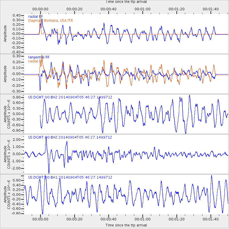
DGMT Dagmar, Montana, USA - Earthquake Result Viewer
*The percent match for this event was below the threshold and hence no stack was calculated.
| Earthquake location: |
Tonga Islands |
| Earthquake latitude/longitude: |
-21.4/-173.3 |
| Earthquake time(UTC): |
2014/09/04 (247) 05:33:46 GMT |
| Earthquake Depth: |
12 km |
| Earthquake Magnitude: |
6.0 MWB |
| Earthquake Catalog/Contributor: |
NEIC PDE/NEIC COMCAT |
|
| Network: |
US United States National Seismic Network |
| Station: |
DGMT Dagmar, Montana, USA |
| Lat/Lon: |
48.47 N/104.20 W |
| Elevation: |
0.0 m |
|
| Distance: |
92.8 deg |
| Az: |
38.485 deg |
| Baz: |
240.625 deg |
| Ray Param: |
$rayparam |
*The percent match for this event was below the threshold and hence was not used in the summary stack. |
|
| Radial Match: |
68.51808 % |
| Radial Bump: |
400 |
| Transverse Match: |
65.31842 % |
| Transverse Bump: |
400 |
| SOD ConfigId: |
790520 |
| Insert Time: |
2014-09-18 06:13:44.043 +0000 |
| GWidth: |
2.5 |
| Max Bumps: |
400 |
| Tol: |
0.001 |
|
Signal To Noise
| Channel | StoN | STA | LTA |
| US:DGMT:00:BHZ:20140904T05:46:27.149971Z | 5.3479333 | 8.739156E-7 | 1.6341184E-7 |
| US:DGMT:00:BH1:20140904T05:46:27.149971Z | 2.2620556 | 5.257886E-7 | 2.3243841E-7 |
| US:DGMT:00:BH2:20140904T05:46:27.149971Z | 1.124726 | 3.7215037E-7 | 3.308809E-7 |
| Arrivals |
| Ps | |
| PpPs | |
| PsPs/PpSs | |


