You are here: Home > Network List > US - United States National Seismic Network Stations List
> Station EGMT Eagleton, Montana, USA > Earthquake Result Viewer
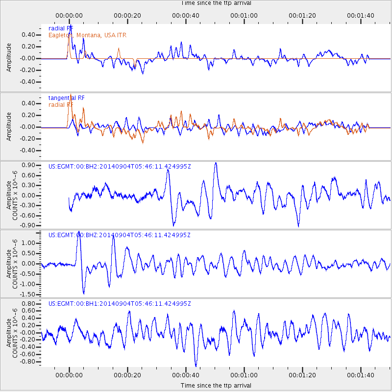
EGMT Eagleton, Montana, USA - Earthquake Result Viewer
*The percent match for this event was below the threshold and hence no stack was calculated.
| Earthquake location: |
Tonga Islands |
| Earthquake latitude/longitude: |
-21.4/-173.3 |
| Earthquake time(UTC): |
2014/09/04 (247) 05:33:46 GMT |
| Earthquake Depth: |
12 km |
| Earthquake Magnitude: |
6.0 MWB |
| Earthquake Catalog/Contributor: |
NEIC PDE/NEIC COMCAT |
|
| Network: |
US United States National Seismic Network |
| Station: |
EGMT Eagleton, Montana, USA |
| Lat/Lon: |
48.02 N/109.75 W |
| Elevation: |
1055 m |
|
| Distance: |
89.4 deg |
| Az: |
36.928 deg |
| Baz: |
236.518 deg |
| Ray Param: |
$rayparam |
*The percent match for this event was below the threshold and hence was not used in the summary stack. |
|
| Radial Match: |
78.96398 % |
| Radial Bump: |
400 |
| Transverse Match: |
63.535027 % |
| Transverse Bump: |
400 |
| SOD ConfigId: |
790520 |
| Insert Time: |
2014-09-18 06:13:53.631 +0000 |
| GWidth: |
2.5 |
| Max Bumps: |
400 |
| Tol: |
0.001 |
|
Signal To Noise
| Channel | StoN | STA | LTA |
| US:EGMT:00:BHZ:20140904T05:46:11.424995Z | 7.6834846 | 7.437007E-7 | 9.6792114E-8 |
| US:EGMT:00:BH1:20140904T05:46:11.424995Z | 1.2560997 | 1.8250435E-7 | 1.4529448E-7 |
| US:EGMT:00:BH2:20140904T05:46:11.424995Z | 2.1301482 | 3.2261863E-7 | 1.5145362E-7 |
| Arrivals |
| Ps | |
| PpPs | |
| PsPs/PpSs | |


