You are here: Home > Network List > UW - Pacific Northwest Regional Seismic Network Stations List
> Station LEBA Lebam, WA, USA > Earthquake Result Viewer
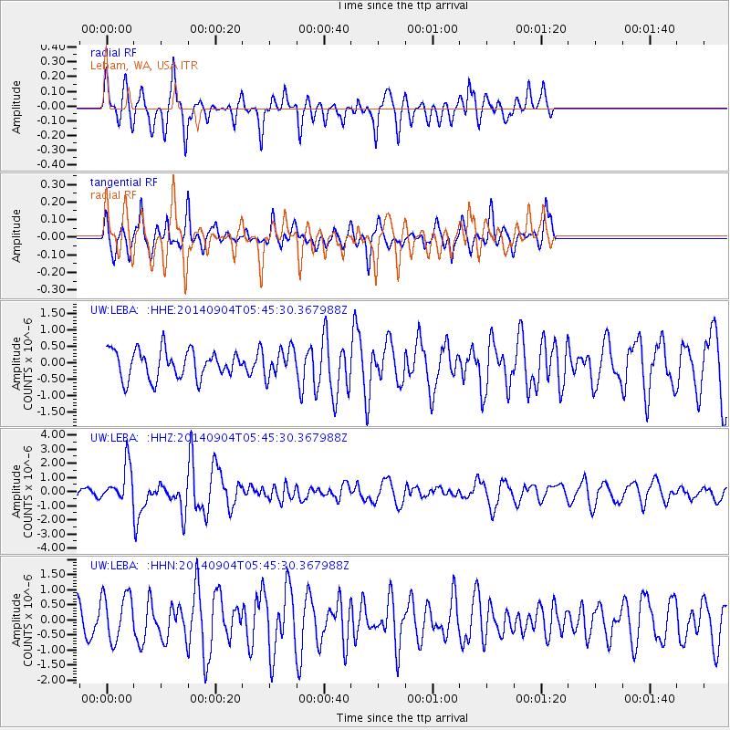
LEBA Lebam, WA, USA - Earthquake Result Viewer
*The percent match for this event was below the threshold and hence no stack was calculated.
| Earthquake location: |
Tonga Islands |
| Earthquake latitude/longitude: |
-21.4/-173.3 |
| Earthquake time(UTC): |
2014/09/04 (247) 05:33:46 GMT |
| Earthquake Depth: |
12 km |
| Earthquake Magnitude: |
6.0 MWB |
| Earthquake Catalog/Contributor: |
NEIC PDE/NEIC COMCAT |
|
| Network: |
UW Pacific Northwest Regional Seismic Network |
| Station: |
LEBA Lebam, WA, USA |
| Lat/Lon: |
46.55 N/123.56 W |
| Elevation: |
73 m |
|
| Distance: |
81.2 deg |
| Az: |
32.186 deg |
| Baz: |
225.99 deg |
| Ray Param: |
$rayparam |
*The percent match for this event was below the threshold and hence was not used in the summary stack. |
|
| Radial Match: |
79.30475 % |
| Radial Bump: |
387 |
| Transverse Match: |
49.607685 % |
| Transverse Bump: |
358 |
| SOD ConfigId: |
790520 |
| Insert Time: |
2014-09-18 06:17:08.904 +0000 |
| GWidth: |
2.5 |
| Max Bumps: |
400 |
| Tol: |
0.001 |
|
Signal To Noise
| Channel | StoN | STA | LTA |
| UW:LEBA: :HHZ:20140904T05:45:30.367988Z | 3.9261668 | 1.3499423E-6 | 3.438321E-7 |
| UW:LEBA: :HHN:20140904T05:45:30.367988Z | 1.3259921 | 7.890718E-7 | 5.950803E-7 |
| UW:LEBA: :HHE:20140904T05:45:30.367988Z | 0.9819252 | 4.1801934E-7 | 4.2571403E-7 |
| Arrivals |
| Ps | |
| PpPs | |
| PsPs/PpSs | |


