You are here: Home > Network List > UW - Pacific Northwest Regional Seismic Network Stations List
> Station MRBL Marblemount, WA, USA > Earthquake Result Viewer
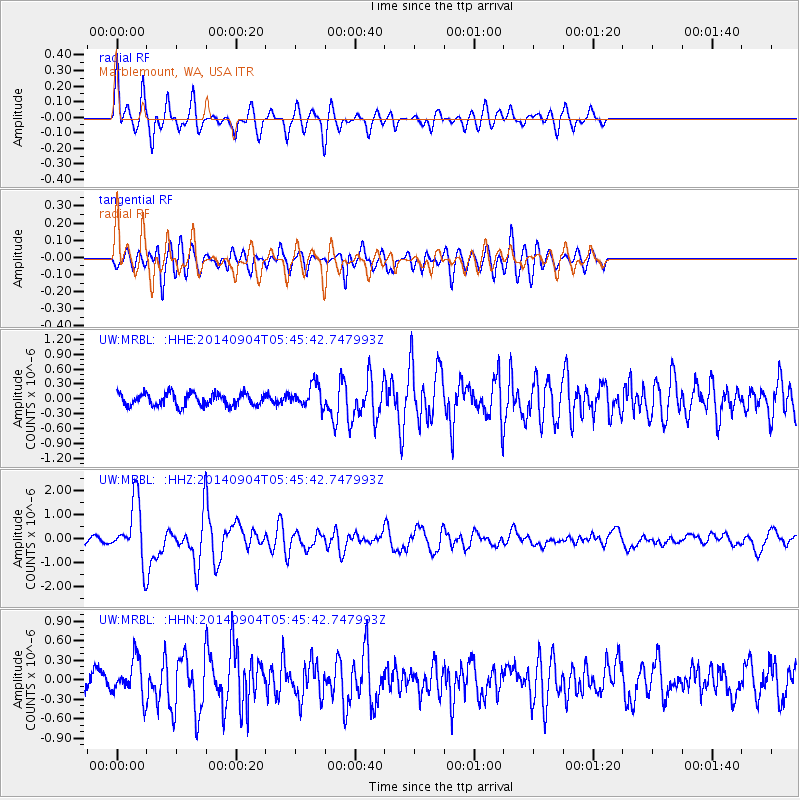
MRBL Marblemount, WA, USA - Earthquake Result Viewer
*The percent match for this event was below the threshold and hence no stack was calculated.
| Earthquake location: |
Tonga Islands |
| Earthquake latitude/longitude: |
-21.4/-173.3 |
| Earthquake time(UTC): |
2014/09/04 (247) 05:33:46 GMT |
| Earthquake Depth: |
12 km |
| Earthquake Magnitude: |
6.0 MWB |
| Earthquake Catalog/Contributor: |
NEIC PDE/NEIC COMCAT |
|
| Network: |
UW Pacific Northwest Regional Seismic Network |
| Station: |
MRBL Marblemount, WA, USA |
| Lat/Lon: |
48.52 N/121.48 W |
| Elevation: |
75 m |
|
| Distance: |
83.5 deg |
| Az: |
31.711 deg |
| Baz: |
227.455 deg |
| Ray Param: |
$rayparam |
*The percent match for this event was below the threshold and hence was not used in the summary stack. |
|
| Radial Match: |
72.10246 % |
| Radial Bump: |
400 |
| Transverse Match: |
72.445816 % |
| Transverse Bump: |
400 |
| SOD ConfigId: |
790520 |
| Insert Time: |
2014-09-18 06:17:18.493 +0000 |
| GWidth: |
2.5 |
| Max Bumps: |
400 |
| Tol: |
0.001 |
|
Signal To Noise
| Channel | StoN | STA | LTA |
| UW:MRBL: :HHZ:20140904T05:45:42.747993Z | 9.5176935 | 1.2214692E-6 | 1.283367E-7 |
| UW:MRBL: :HHN:20140904T05:45:42.747993Z | 3.3747282 | 2.8933772E-7 | 8.5736595E-8 |
| UW:MRBL: :HHE:20140904T05:45:42.747993Z | 1.8042936 | 2.273778E-7 | 1.260204E-7 |
| Arrivals |
| Ps | |
| PpPs | |
| PsPs/PpSs | |


