You are here: Home > Network List > TA - USArray Transportable Network (new EarthScope stations) Stations List
> Station G59A Clarenceville, QC, USA > Earthquake Result Viewer
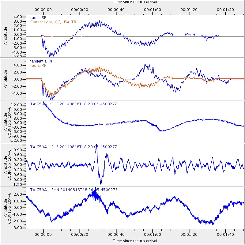
G59A Clarenceville, QC, USA - Earthquake Result Viewer
*The percent match for this event was below the threshold and hence no stack was calculated.
| Earthquake location: |
Iran-Iraq Border Region |
| Earthquake latitude/longitude: |
32.5/47.7 |
| Earthquake time(UTC): |
2014/08/18 (230) 18:07:56 GMT |
| Earthquake Depth: |
10 km |
| Earthquake Magnitude: |
5.8 MWW, 4.1 MB |
| Earthquake Catalog/Contributor: |
NEIC PDE/NEIC COMCAT |
|
| Network: |
TA USArray Transportable Network (new EarthScope stations) |
| Station: |
G59A Clarenceville, QC, USA |
| Lat/Lon: |
45.08 N/73.18 W |
| Elevation: |
36 m |
|
| Distance: |
85.9 deg |
| Az: |
322.427 deg |
| Baz: |
46.628 deg |
| Ray Param: |
$rayparam |
*The percent match for this event was below the threshold and hence was not used in the summary stack. |
|
| Radial Match: |
64.02925 % |
| Radial Bump: |
400 |
| Transverse Match: |
28.277407 % |
| Transverse Bump: |
400 |
| SOD ConfigId: |
790520 |
| Insert Time: |
2014-09-18 16:20:42.103 +0000 |
| GWidth: |
2.5 |
| Max Bumps: |
400 |
| Tol: |
0.001 |
|
Signal To Noise
| Channel | StoN | STA | LTA |
| TA:G59A: :BHZ:20140818T18:20:05.450027Z | 0.84245527 | 1.17091275E-7 | 1.3898813E-7 |
| TA:G59A: :BHN:20140818T18:20:05.450027Z | 0.22842878 | 1.1441937E-6 | 5.0089734E-6 |
| TA:G59A: :BHE:20140818T18:20:05.450027Z | 0.65056604 | 3.095141E-6 | 4.7576123E-6 |
| Arrivals |
| Ps | |
| PpPs | |
| PsPs/PpSs | |


