You are here: Home > Network List > TA - USArray Transportable Network (new EarthScope stations) Stations List
> Station R55A Marlinton, WV, USA > Earthquake Result Viewer
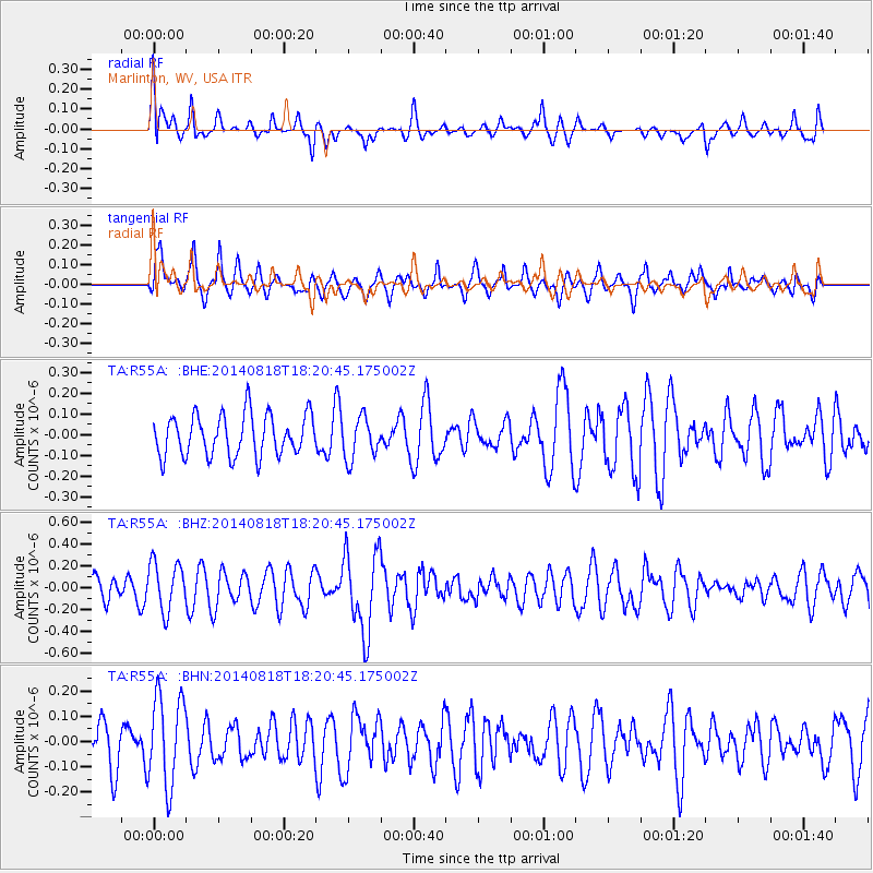
R55A Marlinton, WV, USA - Earthquake Result Viewer
*The percent match for this event was below the threshold and hence no stack was calculated.
| Earthquake location: |
Iran-Iraq Border Region |
| Earthquake latitude/longitude: |
32.5/47.7 |
| Earthquake time(UTC): |
2014/08/18 (230) 18:07:56 GMT |
| Earthquake Depth: |
10 km |
| Earthquake Magnitude: |
5.8 MWW, 4.1 MB |
| Earthquake Catalog/Contributor: |
NEIC PDE/NEIC COMCAT |
|
| Network: |
TA USArray Transportable Network (new EarthScope stations) |
| Station: |
R55A Marlinton, WV, USA |
| Lat/Lon: |
38.28 N/80.12 W |
| Elevation: |
833 m |
|
| Distance: |
94.4 deg |
| Az: |
321.408 deg |
| Baz: |
42.023 deg |
| Ray Param: |
$rayparam |
*The percent match for this event was below the threshold and hence was not used in the summary stack. |
|
| Radial Match: |
67.99317 % |
| Radial Bump: |
400 |
| Transverse Match: |
53.992863 % |
| Transverse Bump: |
398 |
| SOD ConfigId: |
790520 |
| Insert Time: |
2014-09-18 16:22:25.816 +0000 |
| GWidth: |
2.5 |
| Max Bumps: |
400 |
| Tol: |
0.001 |
|
Signal To Noise
| Channel | StoN | STA | LTA |
| TA:R55A: :BHZ:20140818T18:20:45.175002Z | 1.6813112 | 2.2454954E-7 | 1.335562E-7 |
| TA:R55A: :BHN:20140818T18:20:45.175002Z | 2.1646423 | 1.7883033E-7 | 8.261427E-8 |
| TA:R55A: :BHE:20140818T18:20:45.175002Z | 1.0047094 | 1.0064675E-7 | 1.0017499E-7 |
| Arrivals |
| Ps | |
| PpPs | |
| PsPs/PpSs | |


