You are here: Home > Network List > TA - USArray Transportable Network (new EarthScope stations) Stations List
> Station Y59A Loris, SC, USA > Earthquake Result Viewer
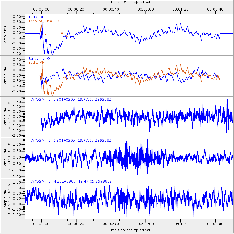
Y59A Loris, SC, USA - Earthquake Result Viewer
*The percent match for this event was below the threshold and hence no stack was calculated.
| Earthquake location: |
Easter Island Region |
| Earthquake latitude/longitude: |
-26.7/-114.3 |
| Earthquake time(UTC): |
2014/09/05 (248) 19:36:32 GMT |
| Earthquake Depth: |
21 km |
| Earthquake Magnitude: |
5.8 MWW, 5.7 MWB, 5.8 MWC |
| Earthquake Catalog/Contributor: |
NEIC PDE/NEIC COMCAT |
|
| Network: |
TA USArray Transportable Network (new EarthScope stations) |
| Station: |
Y59A Loris, SC, USA |
| Lat/Lon: |
33.99 N/78.87 W |
| Elevation: |
2.0 m |
|
| Distance: |
69.1 deg |
| Az: |
31.029 deg |
| Baz: |
213.702 deg |
| Ray Param: |
$rayparam |
*The percent match for this event was below the threshold and hence was not used in the summary stack. |
|
| Radial Match: |
57.569492 % |
| Radial Bump: |
400 |
| Transverse Match: |
47.358555 % |
| Transverse Bump: |
400 |
| SOD ConfigId: |
790520 |
| Insert Time: |
2014-09-19 20:05:10.848 +0000 |
| GWidth: |
2.5 |
| Max Bumps: |
400 |
| Tol: |
0.001 |
|
Signal To Noise
| Channel | StoN | STA | LTA |
| TA:Y59A: :BHZ:20140905T19:47:05.299988Z | 1.1258662 | 2.1868219E-7 | 1.9423462E-7 |
| TA:Y59A: :BHN:20140905T19:47:05.299988Z | 0.9713431 | 4.890272E-7 | 5.0345466E-7 |
| TA:Y59A: :BHE:20140905T19:47:05.299988Z | 1.0689589 | 5.111792E-7 | 4.782029E-7 |
| Arrivals |
| Ps | |
| PpPs | |
| PsPs/PpSs | |


