You are here: Home > Network List > UW - Pacific Northwest Regional Seismic Network Stations List
> Station FISH Seaside, OR, USA > Earthquake Result Viewer
FISH Seaside, OR, USA - Earthquake Result Viewer
*The percent match for this event was below the threshold and hence no stack was calculated.
| Earthquake location: |
Easter Island Region |
| Earthquake latitude/longitude: |
-26.7/-114.3 |
| Earthquake time(UTC): |
2014/09/05 (248) 19:36:32 GMT |
| Earthquake Depth: |
21 km |
| Earthquake Magnitude: |
5.8 MWW, 5.7 MWB, 5.8 MWC |
| Earthquake Catalog/Contributor: |
NEIC PDE/NEIC COMCAT |
|
| Network: |
UW Pacific Northwest Regional Seismic Network |
| Station: |
FISH Seaside, OR, USA |
| Lat/Lon: |
45.93 N/123.56 W |
| Elevation: |
325 m |
|
| Distance: |
72.8 deg |
| Az: |
353.245 deg |
| Baz: |
171.331 deg |
| Ray Param: |
$rayparam |
*The percent match for this event was below the threshold and hence was not used in the summary stack. |
|
| Radial Match: |
44.273663 % |
| Radial Bump: |
400 |
| Transverse Match: |
43.80368 % |
| Transverse Bump: |
400 |
| SOD ConfigId: |
790520 |
| Insert Time: |
2014-09-19 20:07:16.006 +0000 |
| GWidth: |
2.5 |
| Max Bumps: |
400 |
| Tol: |
0.001 |
|
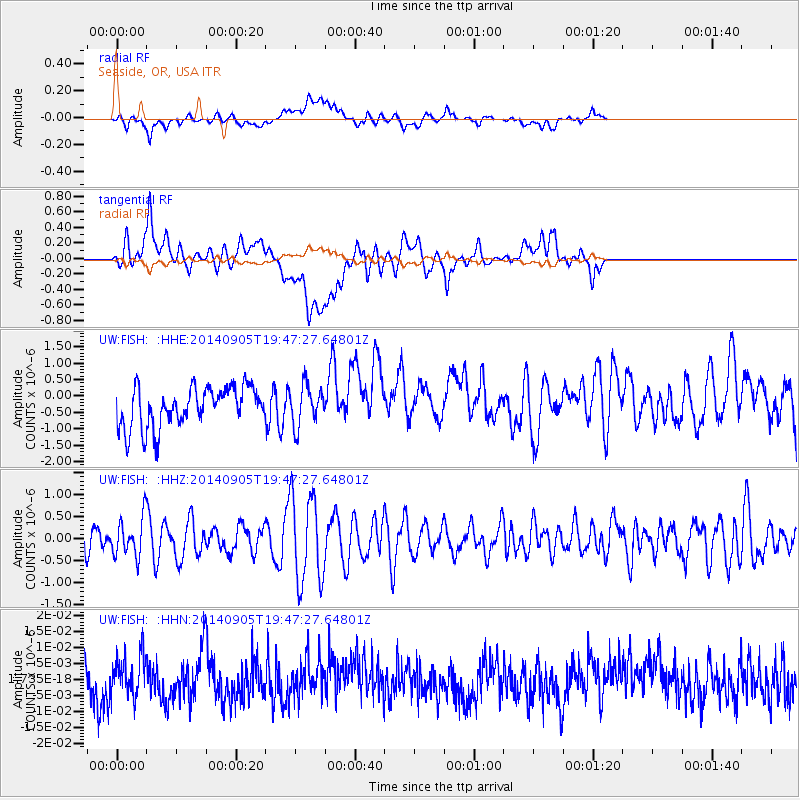
Signal To Noise
| Channel | StoN | STA | LTA |
| UW:FISH: :HHZ:20140905T19:47:27.64801Z | 1.038302 | 4.3418987E-7 | 4.1817304E-7 |
| UW:FISH: :HHN:20140905T19:47:27.64801Z | 1.0341127 | 6.2638916E-9 | 6.057262E-9 |
| UW:FISH: :HHE:20140905T19:47:27.64801Z | 1.0135342 | 6.1489595E-7 | 6.06685E-7 |
| Arrivals |
| Ps | |
| PpPs | |
| PsPs/PpSs | |


