You are here: Home > Network List > TA - USArray Transportable Network (new EarthScope stations) Stations List
> Station I23K Minto, Yukon-Koyukuk, AK, USA > Earthquake Result Viewer
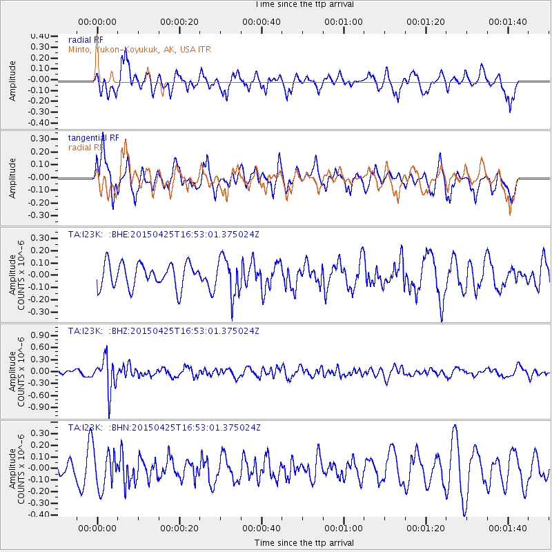
I23K Minto, Yukon-Koyukuk, AK, USA - Earthquake Result Viewer
*The percent match for this event was below the threshold and hence no stack was calculated.
| Earthquake location: |
North Of Halmahera, Indonesia |
| Earthquake latitude/longitude: |
3.0/128.1 |
| Earthquake time(UTC): |
2015/04/25 (115) 16:41:17 GMT |
| Earthquake Depth: |
139 km |
| Earthquake Magnitude: |
5.5 MW, 5.2 mb |
| Earthquake Catalog/Contributor: |
ISC/ISC |
|
| Network: |
TA USArray Transportable Network (new EarthScope stations) |
| Station: |
I23K Minto, Yukon-Koyukuk, AK, USA |
| Lat/Lon: |
65.15 N/149.36 W |
| Elevation: |
149 m |
|
| Distance: |
84.1 deg |
| Az: |
24.915 deg |
| Baz: |
264.527 deg |
| Ray Param: |
$rayparam |
*The percent match for this event was below the threshold and hence was not used in the summary stack. |
|
| Radial Match: |
70.98173 % |
| Radial Bump: |
400 |
| Transverse Match: |
73.49104 % |
| Transverse Bump: |
400 |
| SOD ConfigId: |
7422571 |
| Insert Time: |
2019-04-18 09:44:33.958 +0000 |
| GWidth: |
2.5 |
| Max Bumps: |
400 |
| Tol: |
0.001 |
|
Signal To Noise
| Channel | StoN | STA | LTA |
| TA:I23K: :BHZ:20150425T16:53:01.375024Z | 5.6367273 | 4.0896097E-7 | 7.2552915E-8 |
| TA:I23K: :BHN:20150425T16:53:01.375024Z | 1.7219276 | 1.5093163E-7 | 8.7652715E-8 |
| TA:I23K: :BHE:20150425T16:53:01.375024Z | 1.6102958 | 1.5636371E-7 | 9.7102486E-8 |
| Arrivals |
| Ps | |
| PpPs | |
| PsPs/PpSs | |


