You are here: Home > Network List > TA - USArray Transportable Network (new EarthScope stations) Stations List
> Station N56A West Decatur, PA, USA > Earthquake Result Viewer
N56A West Decatur, PA, USA - Earthquake Result Viewer
| Earthquake location: |
Easter Island Region |
| Earthquake latitude/longitude: |
-26.6/-114.5 |
| Earthquake time(UTC): |
2014/09/06 (249) 06:53:13 GMT |
| Earthquake Depth: |
10 km |
| Earthquake Magnitude: |
6.1 MB |
| Earthquake Catalog/Contributor: |
NEIC PDE/NEIC COMCAT |
|
| Network: |
TA USArray Transportable Network (new EarthScope stations) |
| Station: |
N56A West Decatur, PA, USA |
| Lat/Lon: |
40.92 N/78.30 W |
| Elevation: |
561 m |
|
| Distance: |
75.1 deg |
| Az: |
27.56 deg |
| Baz: |
213.129 deg |
| Ray Param: |
0.051881913 |
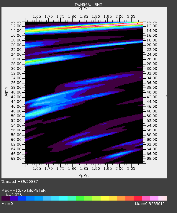
| Estimated Moho Depth: |
10.75 km |
| Estimated Crust Vp/Vs: |
2.08 |
| Assumed Crust Vp: |
6.121 km/s |
| Estimated Crust Vs: |
2.95 km/s |
| Estimated Crust Poisson's Ratio: |
0.35 |
|
| Radial Match: |
89.20887 % |
| Radial Bump: |
396 |
| Transverse Match: |
59.40358 % |
| Transverse Bump: |
400 |
| SOD ConfigId: |
790520 |
| Insert Time: |
2014-09-20 07:46:10.061 +0000 |
| GWidth: |
2.5 |
| Max Bumps: |
400 |
| Tol: |
0.001 |
|
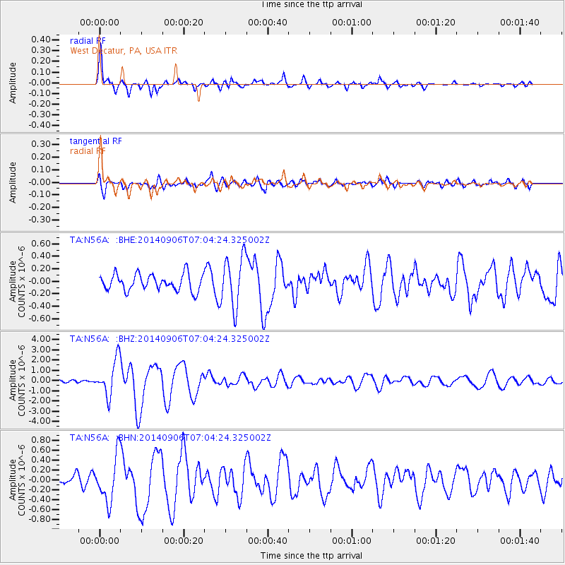
Signal To Noise
| Channel | StoN | STA | LTA |
| TA:N56A: :BHZ:20140906T07:04:24.325002Z | 8.415514 | 1.8171891E-6 | 2.1593324E-7 |
| TA:N56A: :BHN:20140906T07:04:24.325002Z | 2.78927 | 4.755144E-7 | 1.704799E-7 |
| TA:N56A: :BHE:20140906T07:04:24.325002Z | 3.1448944 | 4.080251E-7 | 1.2974208E-7 |
| Arrivals |
| Ps | 1.9 SECOND |
| PpPs | 5.3 SECOND |
| PsPs/PpSs | 7.2 SECOND |


