You are here: Home > Network List > TA - USArray Transportable Network (new EarthScope stations) Stations List
> Station P61A Hammonton, NJ, USA > Earthquake Result Viewer
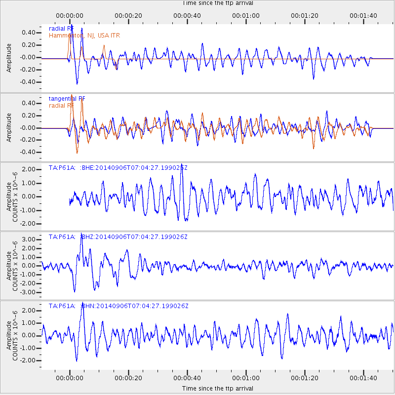
P61A Hammonton, NJ, USA - Earthquake Result Viewer
*The percent match for this event was below the threshold and hence no stack was calculated.
| Earthquake location: |
Easter Island Region |
| Earthquake latitude/longitude: |
-26.6/-114.5 |
| Earthquake time(UTC): |
2014/09/06 (249) 06:53:13 GMT |
| Earthquake Depth: |
10 km |
| Earthquake Magnitude: |
6.1 MB |
| Earthquake Catalog/Contributor: |
NEIC PDE/NEIC COMCAT |
|
| Network: |
TA USArray Transportable Network (new EarthScope stations) |
| Station: |
P61A Hammonton, NJ, USA |
| Lat/Lon: |
39.67 N/74.79 W |
| Elevation: |
22 m |
|
| Distance: |
75.6 deg |
| Az: |
30.568 deg |
| Baz: |
216.147 deg |
| Ray Param: |
$rayparam |
*The percent match for this event was below the threshold and hence was not used in the summary stack. |
|
| Radial Match: |
65.03155 % |
| Radial Bump: |
400 |
| Transverse Match: |
54.931034 % |
| Transverse Bump: |
400 |
| SOD ConfigId: |
790520 |
| Insert Time: |
2014-09-20 07:47:26.897 +0000 |
| GWidth: |
2.5 |
| Max Bumps: |
400 |
| Tol: |
0.001 |
|
Signal To Noise
| Channel | StoN | STA | LTA |
| TA:P61A: :BHZ:20140906T07:04:27.199026Z | 5.592753 | 1.6300747E-6 | 2.9146196E-7 |
| TA:P61A: :BHN:20140906T07:04:27.199026Z | 3.0018117 | 1.2607745E-6 | 4.2000454E-7 |
| TA:P61A: :BHE:20140906T07:04:27.199026Z | 1.7004747 | 7.894977E-7 | 4.6428076E-7 |
| Arrivals |
| Ps | |
| PpPs | |
| PsPs/PpSs | |


