You are here: Home > Network List > TA - USArray Transportable Network (new EarthScope stations) Stations List
> Station Q54A Coxs Mills, WV, USA > Earthquake Result Viewer
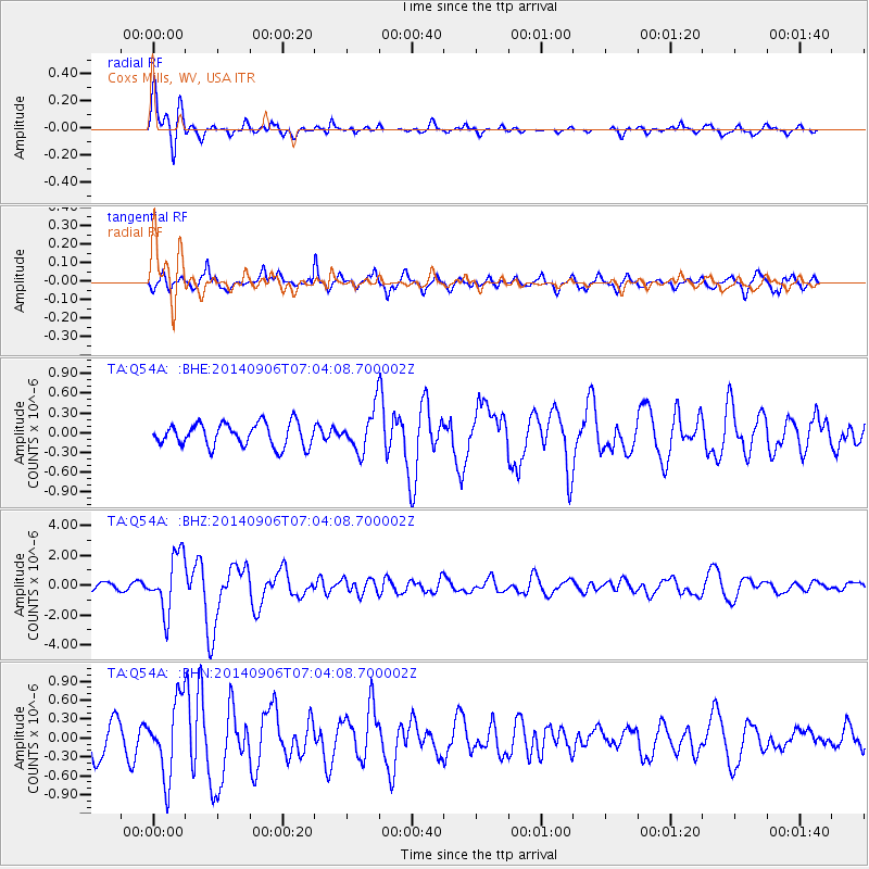
Q54A Coxs Mills, WV, USA - Earthquake Result Viewer
*The percent match for this event was below the threshold and hence no stack was calculated.
| Earthquake location: |
Easter Island Region |
| Earthquake latitude/longitude: |
-26.6/-114.5 |
| Earthquake time(UTC): |
2014/09/06 (249) 06:53:13 GMT |
| Earthquake Depth: |
10 km |
| Earthquake Magnitude: |
6.1 MB |
| Earthquake Catalog/Contributor: |
NEIC PDE/NEIC COMCAT |
|
| Network: |
TA USArray Transportable Network (new EarthScope stations) |
| Station: |
Q54A Coxs Mills, WV, USA |
| Lat/Lon: |
38.98 N/80.83 W |
| Elevation: |
254 m |
|
| Distance: |
72.4 deg |
| Az: |
26.914 deg |
| Baz: |
211.324 deg |
| Ray Param: |
$rayparam |
*The percent match for this event was below the threshold and hence was not used in the summary stack. |
|
| Radial Match: |
78.50167 % |
| Radial Bump: |
400 |
| Transverse Match: |
61.862644 % |
| Transverse Bump: |
400 |
| SOD ConfigId: |
790520 |
| Insert Time: |
2014-09-20 07:47:39.299 +0000 |
| GWidth: |
2.5 |
| Max Bumps: |
400 |
| Tol: |
0.001 |
|
Signal To Noise
| Channel | StoN | STA | LTA |
| TA:Q54A: :BHZ:20140906T07:04:08.700002Z | 9.6778145 | 1.909995E-6 | 1.973581E-7 |
| TA:Q54A: :BHN:20140906T07:04:08.700002Z | 3.0319502 | 5.900525E-7 | 1.9461154E-7 |
| TA:Q54A: :BHE:20140906T07:04:08.700002Z | 1.7754244 | 3.1010745E-7 | 1.7466667E-7 |
| Arrivals |
| Ps | |
| PpPs | |
| PsPs/PpSs | |


