You are here: Home > Network List > TA - USArray Transportable Network (new EarthScope stations) Stations List
> Station I23K Minto, Yukon-Koyukuk, AK, USA > Earthquake Result Viewer
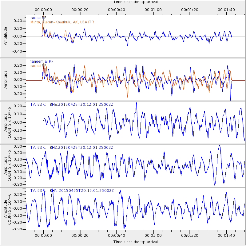
I23K Minto, Yukon-Koyukuk, AK, USA - Earthquake Result Viewer
*The percent match for this event was below the threshold and hence no stack was calculated.
| Earthquake location: |
Taiwan Region |
| Earthquake latitude/longitude: |
23.9/122.5 |
| Earthquake time(UTC): |
2015/04/25 (115) 20:01:36 GMT |
| Earthquake Depth: |
23 km |
| Earthquake Magnitude: |
5.3 MW, 5.4 mb, 4.9 MS |
| Earthquake Catalog/Contributor: |
ISC/ISC |
|
| Network: |
TA USArray Transportable Network (new EarthScope stations) |
| Station: |
I23K Minto, Yukon-Koyukuk, AK, USA |
| Lat/Lon: |
65.15 N/149.36 W |
| Elevation: |
149 m |
|
| Distance: |
67.8 deg |
| Az: |
27.146 deg |
| Baz: |
278.921 deg |
| Ray Param: |
$rayparam |
*The percent match for this event was below the threshold and hence was not used in the summary stack. |
|
| Radial Match: |
55.752686 % |
| Radial Bump: |
400 |
| Transverse Match: |
65.3112 % |
| Transverse Bump: |
400 |
| SOD ConfigId: |
7422571 |
| Insert Time: |
2019-04-18 09:52:27.844 +0000 |
| GWidth: |
2.5 |
| Max Bumps: |
400 |
| Tol: |
0.001 |
|
Signal To Noise
| Channel | StoN | STA | LTA |
| TA:I23K: :BHZ:20150425T20:12:01.25002Z | 1.1542015 | 1.346377E-7 | 1.16650085E-7 |
| TA:I23K: :BHN:20150425T20:12:01.25002Z | 2.4099123 | 1.9989294E-7 | 8.2946144E-8 |
| TA:I23K: :BHE:20150425T20:12:01.25002Z | 1.2682931 | 9.675534E-8 | 7.628784E-8 |
| Arrivals |
| Ps | |
| PpPs | |
| PsPs/PpSs | |


