You are here: Home > Network List > US - United States National Seismic Network Stations List
> Station DGMT Dagmar, Montana, USA > Earthquake Result Viewer
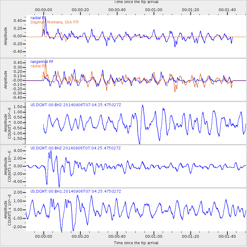
DGMT Dagmar, Montana, USA - Earthquake Result Viewer
*The percent match for this event was below the threshold and hence no stack was calculated.
| Earthquake location: |
Easter Island Region |
| Earthquake latitude/longitude: |
-26.6/-114.5 |
| Earthquake time(UTC): |
2014/09/06 (249) 06:53:13 GMT |
| Earthquake Depth: |
10 km |
| Earthquake Magnitude: |
6.1 MB |
| Earthquake Catalog/Contributor: |
NEIC PDE/NEIC COMCAT |
|
| Network: |
US United States National Seismic Network |
| Station: |
DGMT Dagmar, Montana, USA |
| Lat/Lon: |
48.47 N/104.20 W |
| Elevation: |
0.0 m |
|
| Distance: |
75.3 deg |
| Az: |
7.039 deg |
| Baz: |
189.488 deg |
| Ray Param: |
$rayparam |
*The percent match for this event was below the threshold and hence was not used in the summary stack. |
|
| Radial Match: |
72.17687 % |
| Radial Bump: |
400 |
| Transverse Match: |
62.0955 % |
| Transverse Bump: |
353 |
| SOD ConfigId: |
790520 |
| Insert Time: |
2014-09-20 07:53:53.240 +0000 |
| GWidth: |
2.5 |
| Max Bumps: |
400 |
| Tol: |
0.001 |
|
Signal To Noise
| Channel | StoN | STA | LTA |
| US:DGMT:00:BHZ:20140906T07:04:25.475027Z | 10.78077 | 2.3823338E-6 | 2.2097993E-7 |
| US:DGMT:00:BH1:20140906T07:04:25.475027Z | 1.0081956 | 6.54348E-7 | 6.490288E-7 |
| US:DGMT:00:BH2:20140906T07:04:25.475027Z | 0.96630865 | 4.3636524E-7 | 4.5157955E-7 |
| Arrivals |
| Ps | |
| PpPs | |
| PsPs/PpSs | |


