You are here: Home > Network List > UW - Pacific Northwest Regional Seismic Network Stations List
> Station MRBL Marblemount, WA, USA > Earthquake Result Viewer
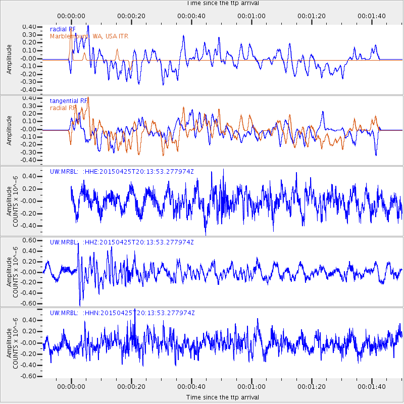
MRBL Marblemount, WA, USA - Earthquake Result Viewer
*The percent match for this event was below the threshold and hence no stack was calculated.
| Earthquake location: |
Taiwan Region |
| Earthquake latitude/longitude: |
23.9/122.5 |
| Earthquake time(UTC): |
2015/04/25 (115) 20:01:36 GMT |
| Earthquake Depth: |
23 km |
| Earthquake Magnitude: |
5.3 MW, 5.4 mb, 4.9 MS |
| Earthquake Catalog/Contributor: |
ISC/ISC |
|
| Network: |
UW Pacific Northwest Regional Seismic Network |
| Station: |
MRBL Marblemount, WA, USA |
| Lat/Lon: |
48.52 N/121.48 W |
| Elevation: |
75 m |
|
| Distance: |
88.0 deg |
| Az: |
36.717 deg |
| Baz: |
304.634 deg |
| Ray Param: |
$rayparam |
*The percent match for this event was below the threshold and hence was not used in the summary stack. |
|
| Radial Match: |
48.74744 % |
| Radial Bump: |
400 |
| Transverse Match: |
46.986885 % |
| Transverse Bump: |
400 |
| SOD ConfigId: |
7422571 |
| Insert Time: |
2019-04-18 09:53:01.709 +0000 |
| GWidth: |
2.5 |
| Max Bumps: |
400 |
| Tol: |
0.001 |
|
Signal To Noise
| Channel | StoN | STA | LTA |
| UW:MRBL: :HHZ:20150425T20:13:53.277974Z | 2.8979156 | 2.4253947E-7 | 8.369446E-8 |
| UW:MRBL: :HHN:20150425T20:13:53.277974Z | 1.6127664 | 1.77036E-7 | 1.09771634E-7 |
| UW:MRBL: :HHE:20150425T20:13:53.277974Z | 1.1209764 | 1.5972424E-7 | 1.424867E-7 |
| Arrivals |
| Ps | |
| PpPs | |
| PsPs/PpSs | |


