You are here: Home > Network List > UW - Pacific Northwest Regional Seismic Network Stations List
> Station MRBL Marblemount, WA, USA > Earthquake Result Viewer
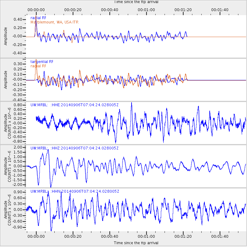
MRBL Marblemount, WA, USA - Earthquake Result Viewer
*The percent match for this event was below the threshold and hence no stack was calculated.
| Earthquake location: |
Easter Island Region |
| Earthquake latitude/longitude: |
-26.6/-114.5 |
| Earthquake time(UTC): |
2014/09/06 (249) 06:53:13 GMT |
| Earthquake Depth: |
10 km |
| Earthquake Magnitude: |
6.1 MB |
| Earthquake Catalog/Contributor: |
NEIC PDE/NEIC COMCAT |
|
| Network: |
UW Pacific Northwest Regional Seismic Network |
| Station: |
MRBL Marblemount, WA, USA |
| Lat/Lon: |
48.52 N/121.48 W |
| Elevation: |
75 m |
|
| Distance: |
75.1 deg |
| Az: |
355.17 deg |
| Baz: |
173.491 deg |
| Ray Param: |
$rayparam |
*The percent match for this event was below the threshold and hence was not used in the summary stack. |
|
| Radial Match: |
75.047806 % |
| Radial Bump: |
400 |
| Transverse Match: |
71.33513 % |
| Transverse Bump: |
400 |
| SOD ConfigId: |
790520 |
| Insert Time: |
2014-09-20 07:57:31.681 +0000 |
| GWidth: |
2.5 |
| Max Bumps: |
400 |
| Tol: |
0.001 |
|
Signal To Noise
| Channel | StoN | STA | LTA |
| UW:MRBL: :HHZ:20140906T07:04:24.028005Z | 10.959305 | 9.5321246E-7 | 8.697746E-8 |
| UW:MRBL: :HHN:20140906T07:04:24.028005Z | 3.4169405 | 3.8582934E-7 | 1.1291661E-7 |
| UW:MRBL: :HHE:20140906T07:04:24.028005Z | 0.9907817 | 1.4882002E-7 | 1.5020464E-7 |
| Arrivals |
| Ps | |
| PpPs | |
| PsPs/PpSs | |


