You are here: Home > Network List > TA - USArray Transportable Network (new EarthScope stations) Stations List
> Station G59A Clarenceville, QC, USA > Earthquake Result Viewer
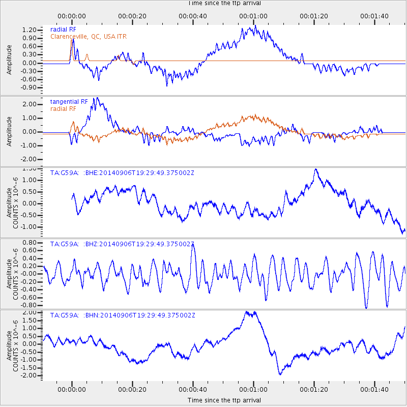
G59A Clarenceville, QC, USA - Earthquake Result Viewer
*The percent match for this event was below the threshold and hence no stack was calculated.
| Earthquake location: |
Off Coast Of Jalisco, Mexico |
| Earthquake latitude/longitude: |
18.8/-107.0 |
| Earthquake time(UTC): |
2014/09/06 (249) 19:23:00 GMT |
| Earthquake Depth: |
18 km |
| Earthquake Magnitude: |
5.9 MWB |
| Earthquake Catalog/Contributor: |
NEIC PDE/NEIC COMCAT |
|
| Network: |
TA USArray Transportable Network (new EarthScope stations) |
| Station: |
G59A Clarenceville, QC, USA |
| Lat/Lon: |
45.08 N/73.18 W |
| Elevation: |
36 m |
|
| Distance: |
38.4 deg |
| Az: |
39.448 deg |
| Baz: |
238.142 deg |
| Ray Param: |
$rayparam |
*The percent match for this event was below the threshold and hence was not used in the summary stack. |
|
| Radial Match: |
33.79477 % |
| Radial Bump: |
400 |
| Transverse Match: |
47.81946 % |
| Transverse Bump: |
400 |
| SOD ConfigId: |
790520 |
| Insert Time: |
2014-09-20 19:49:44.712 +0000 |
| GWidth: |
2.5 |
| Max Bumps: |
400 |
| Tol: |
0.001 |
|
Signal To Noise
| Channel | StoN | STA | LTA |
| TA:G59A: :BHZ:20140906T19:29:49.375002Z | 1.1334779 | 1.7776459E-7 | 1.568311E-7 |
| TA:G59A: :BHN:20140906T19:29:49.375002Z | 1.4438689 | 8.6668854E-7 | 6.0025434E-7 |
| TA:G59A: :BHE:20140906T19:29:49.375002Z | 2.468189 | 7.167735E-7 | 2.9040464E-7 |
| Arrivals |
| Ps | |
| PpPs | |
| PsPs/PpSs | |


