You are here: Home > Network List > TA - USArray Transportable Network (new EarthScope stations) Stations List
> Station M52A Chesterland, OH, USA > Earthquake Result Viewer
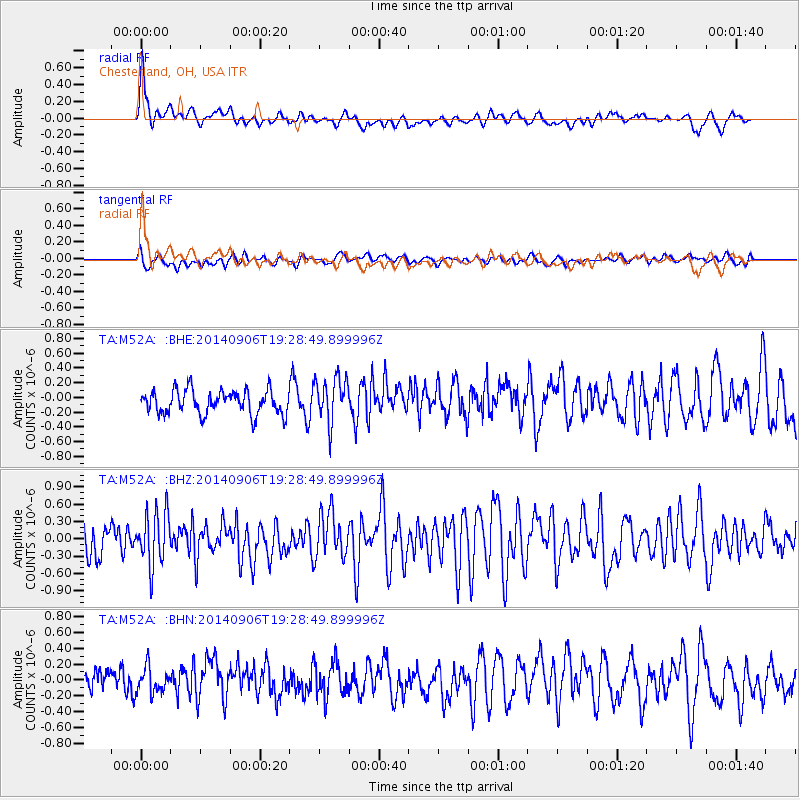
M52A Chesterland, OH, USA - Earthquake Result Viewer
*The percent match for this event was below the threshold and hence no stack was calculated.
| Earthquake location: |
Off Coast Of Jalisco, Mexico |
| Earthquake latitude/longitude: |
18.8/-107.0 |
| Earthquake time(UTC): |
2014/09/06 (249) 19:23:00 GMT |
| Earthquake Depth: |
18 km |
| Earthquake Magnitude: |
5.9 MWB |
| Earthquake Catalog/Contributor: |
NEIC PDE/NEIC COMCAT |
|
| Network: |
TA USArray Transportable Network (new EarthScope stations) |
| Station: |
M52A Chesterland, OH, USA |
| Lat/Lon: |
41.54 N/81.36 W |
| Elevation: |
382 m |
|
| Distance: |
31.5 deg |
| Az: |
38.515 deg |
| Baz: |
231.78 deg |
| Ray Param: |
$rayparam |
*The percent match for this event was below the threshold and hence was not used in the summary stack. |
|
| Radial Match: |
76.54995 % |
| Radial Bump: |
400 |
| Transverse Match: |
53.96124 % |
| Transverse Bump: |
400 |
| SOD ConfigId: |
790520 |
| Insert Time: |
2014-09-20 19:50:54.974 +0000 |
| GWidth: |
2.5 |
| Max Bumps: |
400 |
| Tol: |
0.001 |
|
Signal To Noise
| Channel | StoN | STA | LTA |
| TA:M52A: :BHZ:20140906T19:28:49.899996Z | 2.246334 | 4.6033605E-7 | 2.049277E-7 |
| TA:M52A: :BHN:20140906T19:28:49.899996Z | 1.1794624 | 1.5769588E-7 | 1.3370149E-7 |
| TA:M52A: :BHE:20140906T19:28:49.899996Z | 1.9163332 | 3.0294763E-7 | 1.5808713E-7 |
| Arrivals |
| Ps | |
| PpPs | |
| PsPs/PpSs | |


