You are here: Home > Network List > AV - Alaska Volcano Observatory Stations List
> Station MNAT Nateekin Bay, Makushin Volcano, Alaska > Earthquake Result Viewer
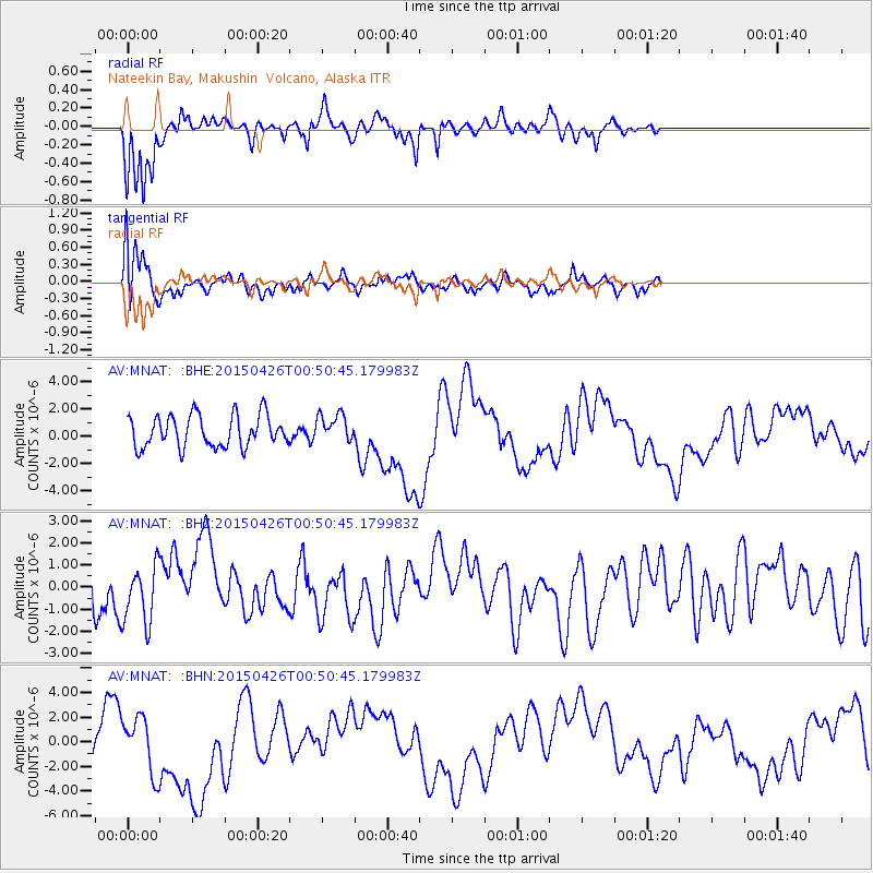
MNAT Nateekin Bay, Makushin Volcano, Alaska - Earthquake Result Viewer
*The percent match for this event was below the threshold and hence no stack was calculated.
| Earthquake location: |
South Of Mariana Islands |
| Earthquake latitude/longitude: |
12.8/143.7 |
| Earthquake time(UTC): |
2015/04/26 (116) 00:41:44 GMT |
| Earthquake Depth: |
105 km |
| Earthquake Magnitude: |
4.7 mb, 4.7 mb |
| Earthquake Catalog/Contributor: |
ISC/ISC |
|
| Network: |
AV Alaska Volcano Observatory |
| Station: |
MNAT Nateekin Bay, Makushin Volcano, Alaska |
| Lat/Lon: |
53.88 N/166.69 W |
| Elevation: |
390 m |
|
| Distance: |
56.5 deg |
| Az: |
32.735 deg |
| Baz: |
242.994 deg |
| Ray Param: |
$rayparam |
*The percent match for this event was below the threshold and hence was not used in the summary stack. |
|
| Radial Match: |
79.35469 % |
| Radial Bump: |
360 |
| Transverse Match: |
71.018654 % |
| Transverse Bump: |
400 |
| SOD ConfigId: |
7422571 |
| Insert Time: |
2019-04-18 12:41:46.804 +0000 |
| GWidth: |
2.5 |
| Max Bumps: |
400 |
| Tol: |
0.001 |
|
Signal To Noise
| Channel | StoN | STA | LTA |
| AV:MNAT: :BHZ:20150426T00:50:45.179983Z | 1.1243874 | 1.2672268E-6 | 1.1270375E-6 |
| AV:MNAT: :BHN:20150426T00:50:45.179983Z | 1.8619435 | 2.2572065E-6 | 1.2122852E-6 |
| AV:MNAT: :BHE:20150426T00:50:45.179983Z | 0.878928 | 1.0166183E-6 | 1.156657E-6 |
| Arrivals |
| Ps | |
| PpPs | |
| PsPs/PpSs | |


