You are here: Home > Network List > CN - Canadian National Seismograph Network Stations List
> Station INK INUVIK, NT > Earthquake Result Viewer
INK INUVIK, NT - Earthquake Result Viewer

| Earthquake location: |
Nepal |
| Earthquake latitude/longitude: |
27.8/86.0 |
| Earthquake time(UTC): |
2015/04/26 (116) 07:09:08 GMT |
| Earthquake Depth: |
10 km |
| Earthquake Magnitude: |
6.7 MWP |
| Earthquake Catalog/Contributor: |
NEIC PDE/NEIC COMCAT |
|
| Network: |
CN Canadian National Seismograph Network |
| Station: |
INK INUVIK, NT |
| Lat/Lon: |
68.31 N/133.53 W |
| Elevation: |
44 m |
|
| Distance: |
79.8 deg |
| Az: |
13.901 deg |
| Baz: |
325.076 deg |
| Ray Param: |
0.04868738 |
| Estimated Moho Depth: |
69.75 km |
| Estimated Crust Vp/Vs: |
1.79 |
| Assumed Crust Vp: |
6.171 km/s |
| Estimated Crust Vs: |
3.448 km/s |
| Estimated Crust Poisson's Ratio: |
0.27 |
|
| Radial Match: |
97.92622 % |
| Radial Bump: |
313 |
| Transverse Match: |
94.92302 % |
| Transverse Bump: |
400 |
| SOD ConfigId: |
7422571 |
| Insert Time: |
2019-04-18 12:48:01.808 +0000 |
| GWidth: |
2.5 |
| Max Bumps: |
400 |
| Tol: |
0.001 |
|
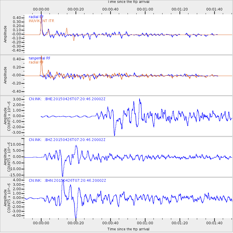
Signal To Noise
| Channel | StoN | STA | LTA |
| CN:INK: :BHZ:20150426T07:20:46.20002Z | 25.170437 | 1.5118793E-6 | 6.006567E-8 |
| CN:INK: :BHN:20150426T07:20:46.20002Z | 5.8320837 | 4.2097676E-7 | 7.218291E-8 |
| CN:INK: :BHE:20150426T07:20:46.20002Z | 3.881722 | 2.9368078E-7 | 7.565735E-8 |
| Arrivals |
| Ps | 9.2 SECOND |
| PpPs | 31 SECOND |
| PsPs/PpSs | 40 SECOND |


