You are here: Home > Network List > TA - USArray Transportable Network (new EarthScope stations) Stations List
> Station R11A Troy Canyon, Currant, NV, USA > Earthquake Result Viewer
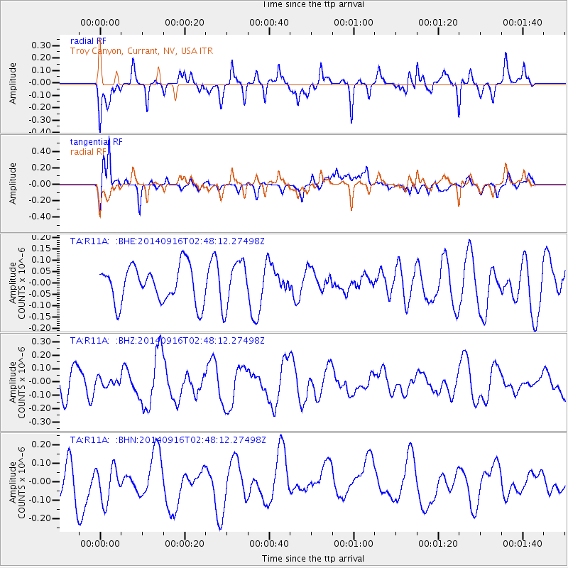
R11A Troy Canyon, Currant, NV, USA - Earthquake Result Viewer
*The percent match for this event was below the threshold and hence no stack was calculated.
| Earthquake location: |
New Britain Region, P.N.G. |
| Earthquake latitude/longitude: |
-6.3/151.7 |
| Earthquake time(UTC): |
2014/09/16 (259) 02:35:19 GMT |
| Earthquake Depth: |
25 km |
| Earthquake Magnitude: |
5.6 MB |
| Earthquake Catalog/Contributor: |
NEIC PDE/NEIC COMCAT |
|
| Network: |
TA USArray Transportable Network (new EarthScope stations) |
| Station: |
R11A Troy Canyon, Currant, NV, USA |
| Lat/Lon: |
38.35 N/115.59 W |
| Elevation: |
1756 m |
|
| Distance: |
96.0 deg |
| Az: |
52.154 deg |
| Baz: |
266.766 deg |
| Ray Param: |
$rayparam |
*The percent match for this event was below the threshold and hence was not used in the summary stack. |
|
| Radial Match: |
70.75454 % |
| Radial Bump: |
400 |
| Transverse Match: |
68.37521 % |
| Transverse Bump: |
400 |
| SOD ConfigId: |
795072 |
| Insert Time: |
2014-09-30 03:39:54.246 +0000 |
| GWidth: |
2.5 |
| Max Bumps: |
400 |
| Tol: |
0.001 |
|
Signal To Noise
| Channel | StoN | STA | LTA |
| TA:R11A: :BHZ:20140916T02:48:12.27498Z | 0.35868314 | 2.9964998E-8 | 8.354169E-8 |
| TA:R11A: :BHN:20140916T02:48:12.27498Z | 1.133909 | 1.07568034E-7 | 9.486479E-8 |
| TA:R11A: :BHE:20140916T02:48:12.27498Z | 1.2766688 | 1.01755916E-7 | 7.970424E-8 |
| Arrivals |
| Ps | |
| PpPs | |
| PsPs/PpSs | |


