You are here: Home > Network List > AV - Alaska Volcano Observatory Stations List
> Station SPCR Ckakachatna River, Mount Spurr, Alaska > Earthquake Result Viewer
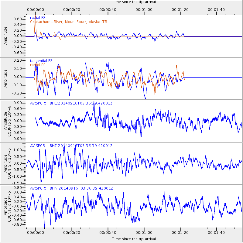
SPCR Ckakachatna River, Mount Spurr, Alaska - Earthquake Result Viewer
*The percent match for this event was below the threshold and hence no stack was calculated.
| Earthquake location: |
Eastern Honshu, Japan |
| Earthquake latitude/longitude: |
36.1/139.9 |
| Earthquake time(UTC): |
2014/09/16 (259) 03:28:31 GMT |
| Earthquake Depth: |
54 km |
| Earthquake Magnitude: |
5.6 MB |
| Earthquake Catalog/Contributor: |
NEIC PDE/NEIC COMCAT |
|
| Network: |
AV Alaska Volcano Observatory |
| Station: |
SPCR Ckakachatna River, Mount Spurr, Alaska |
| Lat/Lon: |
61.20 N/152.21 W |
| Elevation: |
984 m |
|
| Distance: |
48.7 deg |
| Az: |
36.69 deg |
| Baz: |
271.318 deg |
| Ray Param: |
$rayparam |
*The percent match for this event was below the threshold and hence was not used in the summary stack. |
|
| Radial Match: |
48.831223 % |
| Radial Bump: |
400 |
| Transverse Match: |
58.74337 % |
| Transverse Bump: |
400 |
| SOD ConfigId: |
795072 |
| Insert Time: |
2014-09-30 03:52:28.721 +0000 |
| GWidth: |
2.5 |
| Max Bumps: |
400 |
| Tol: |
0.001 |
|
Signal To Noise
| Channel | StoN | STA | LTA |
| AV:SPCR: :BHZ:20140916T03:36:39.42001Z | 3.0680056 | 6.230737E-7 | 2.0308752E-7 |
| AV:SPCR: :BHN:20140916T03:36:39.42001Z | 1.6720989 | 3.1556397E-7 | 1.8872326E-7 |
| AV:SPCR: :BHE:20140916T03:36:39.42001Z | 3.095636 | 4.0161498E-7 | 1.2973585E-7 |
| Arrivals |
| Ps | |
| PpPs | |
| PsPs/PpSs | |


