You are here: Home > Network List > TA - USArray Transportable Network (new EarthScope stations) Stations List
> Station F61A St Evariste, QC, CAN > Earthquake Result Viewer
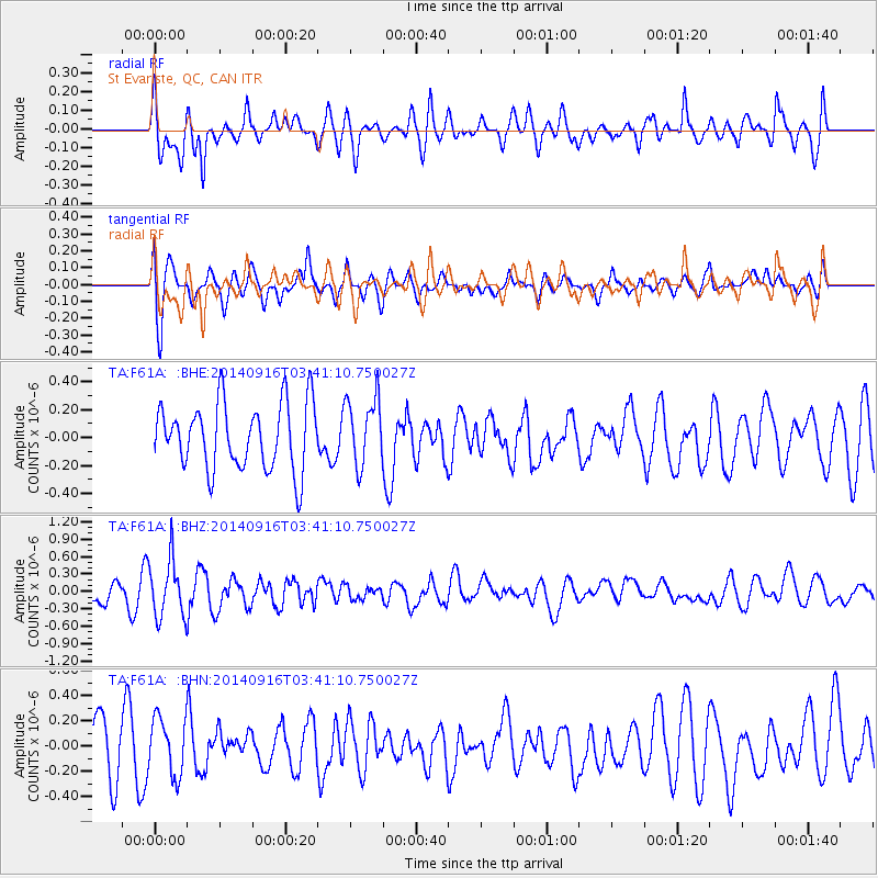
F61A St Evariste, QC, CAN - Earthquake Result Viewer
*The percent match for this event was below the threshold and hence no stack was calculated.
| Earthquake location: |
Eastern Honshu, Japan |
| Earthquake latitude/longitude: |
36.1/139.9 |
| Earthquake time(UTC): |
2014/09/16 (259) 03:28:31 GMT |
| Earthquake Depth: |
54 km |
| Earthquake Magnitude: |
5.6 MB |
| Earthquake Catalog/Contributor: |
NEIC PDE/NEIC COMCAT |
|
| Network: |
TA USArray Transportable Network (new EarthScope stations) |
| Station: |
F61A St Evariste, QC, CAN |
| Lat/Lon: |
45.97 N/70.99 W |
| Elevation: |
350 m |
|
| Distance: |
93.7 deg |
| Az: |
21.011 deg |
| Baz: |
335.382 deg |
| Ray Param: |
$rayparam |
*The percent match for this event was below the threshold and hence was not used in the summary stack. |
|
| Radial Match: |
66.0345 % |
| Radial Bump: |
400 |
| Transverse Match: |
73.128784 % |
| Transverse Bump: |
400 |
| SOD ConfigId: |
795072 |
| Insert Time: |
2014-09-30 04:34:19.980 +0000 |
| GWidth: |
2.5 |
| Max Bumps: |
400 |
| Tol: |
0.001 |
|
Signal To Noise
| Channel | StoN | STA | LTA |
| TA:F61A: :BHZ:20140916T03:41:10.750027Z | 1.7359362 | 4.9353844E-7 | 2.843068E-7 |
| TA:F61A: :BHN:20140916T03:41:10.750027Z | 0.86031264 | 2.2711195E-7 | 2.6398772E-7 |
| TA:F61A: :BHE:20140916T03:41:10.750027Z | 1.0223044 | 2.4259018E-7 | 2.372974E-7 |
| Arrivals |
| Ps | |
| PpPs | |
| PsPs/PpSs | |


