You are here: Home > Network List > TA - USArray Transportable Network (new EarthScope stations) Stations List
> Station O03E Paynes Creek, CA, USA > Earthquake Result Viewer
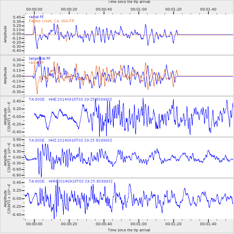
O03E Paynes Creek, CA, USA - Earthquake Result Viewer
*The percent match for this event was below the threshold and hence no stack was calculated.
| Earthquake location: |
Eastern Honshu, Japan |
| Earthquake latitude/longitude: |
36.1/139.9 |
| Earthquake time(UTC): |
2014/09/16 (259) 03:28:31 GMT |
| Earthquake Depth: |
54 km |
| Earthquake Magnitude: |
5.6 MB |
| Earthquake Catalog/Contributor: |
NEIC PDE/NEIC COMCAT |
|
| Network: |
TA USArray Transportable Network (new EarthScope stations) |
| Station: |
O03E Paynes Creek, CA, USA |
| Lat/Lon: |
40.29 N/121.80 W |
| Elevation: |
967 m |
|
| Distance: |
73.3 deg |
| Az: |
52.209 deg |
| Baz: |
303.16 deg |
| Ray Param: |
$rayparam |
*The percent match for this event was below the threshold and hence was not used in the summary stack. |
|
| Radial Match: |
62.669586 % |
| Radial Bump: |
400 |
| Transverse Match: |
71.950966 % |
| Transverse Bump: |
400 |
| SOD ConfigId: |
795072 |
| Insert Time: |
2014-09-30 04:37:30.310 +0000 |
| GWidth: |
2.5 |
| Max Bumps: |
400 |
| Tol: |
0.001 |
|
Signal To Noise
| Channel | StoN | STA | LTA |
| TA:O03E: :HHZ:20140916T03:39:25.839993Z | 3.4689193 | 3.9142137E-7 | 1.12836695E-7 |
| TA:O03E: :HHN:20140916T03:39:25.839993Z | 1.2335303 | 1.2759837E-7 | 1.0344162E-7 |
| TA:O03E: :HHE:20140916T03:39:25.839993Z | 1.3410602 | 1.4669135E-7 | 1.0938461E-7 |
| Arrivals |
| Ps | |
| PpPs | |
| PsPs/PpSs | |


